


From Schwarzsee to Les Paccots in 3 days
June 2021
With 29 sections, the Alpine Panorama Trail reaches from Rorschach to Geneva. Some sections are labeled as “Mountain Hiking trails”, but most fall in the category of regular hiking trails. The idea of this hike is more, that you have a view of the alps, rather than actually hiking in the Alps.
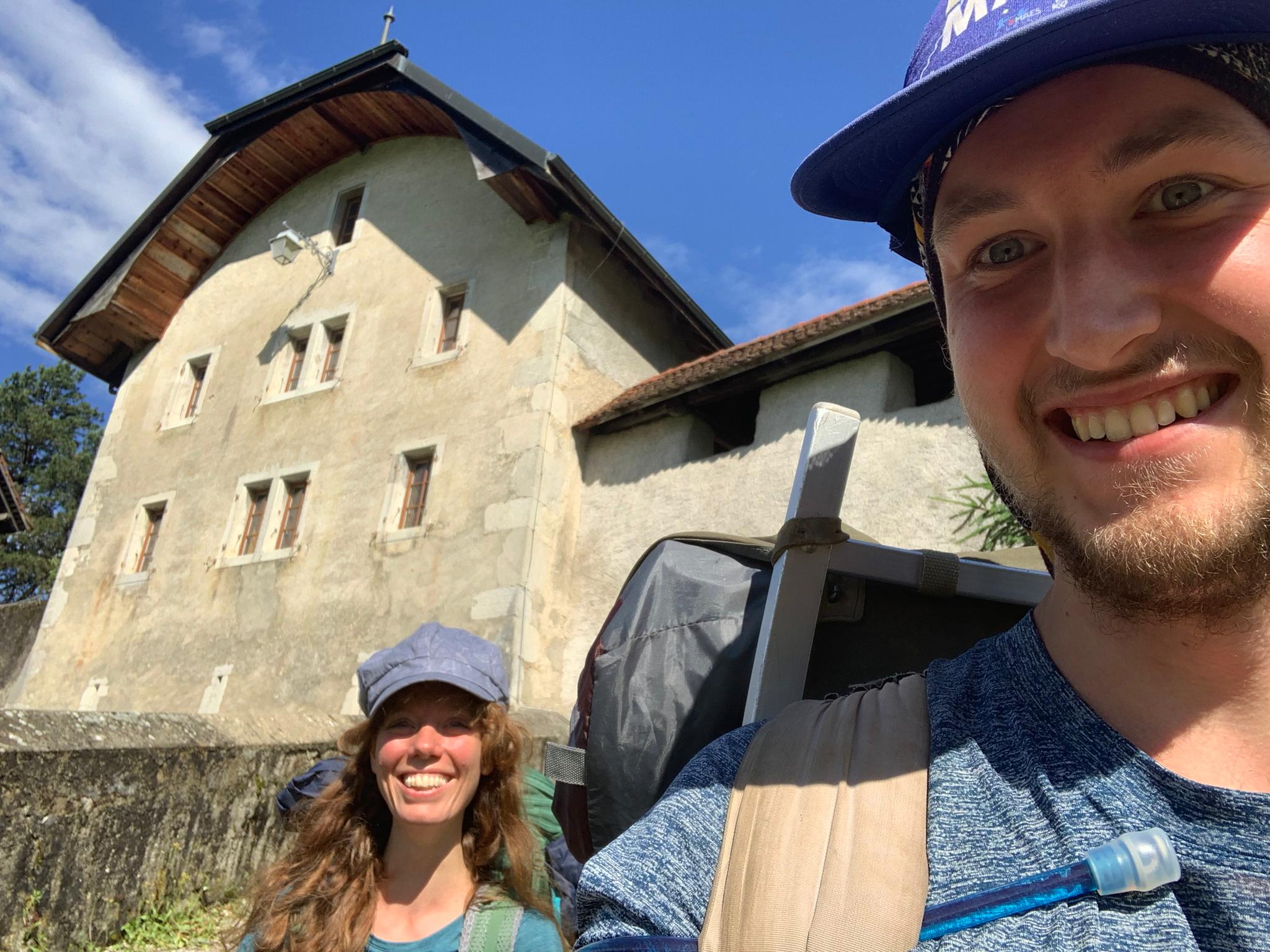
For this hike Sam and me invited my Cousin Joris along as a birthday present. We planned to together hike the section from Schwarzsee to Jaun, from Jaun to Gruyères and from Gruyères to Les Paccots. From there Joris would go back home and Sam and me would add another day from Les Paccots to Vevey. How that in the end all turned out will be shared below. But Sam and me did not end up in Vevey…
Day 1: Schwarzsee to Jaun
The travel from Le Creux-des-Biches to Schwarzsee was a long one. We had to change trains several time and where originally meant to meet Joris, who came from Basel, in Bern. But he unfortunately missed his connection and so Sam and me went ahead to Schwarzsee to wait for him there. Being as it was a beautiful sunny day in June, the Bus from Fribourg was completely packed. We where relieved to get out and breathe the fresh air. Knowing that we had a full hour to wait until Joris would arrive with the next bus, we got ourselves something to eat and sat down at the lakeside. The lake lives up to his name, with the water having a dark almost black color; a whole flock of ducks where peacefully swimming in the water along with some Stand-Up Paddlers and kids. The atmosphere was peaceful, the weather beautiful and warm and the surrounding mountains were calling us to come explore.
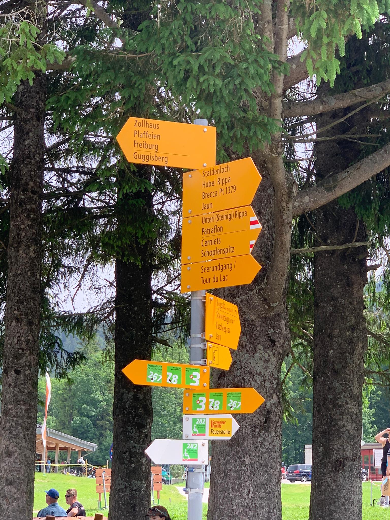
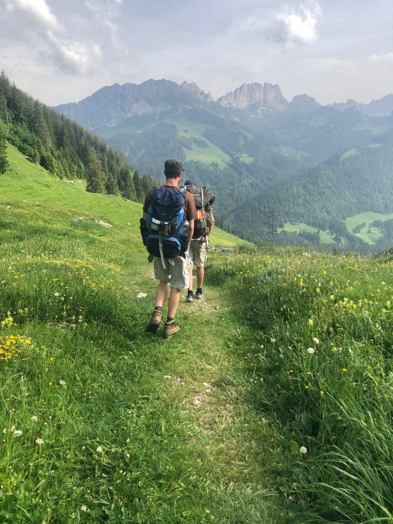
Once Joris arrived we didn’t waste any time, to let the first big hiking sign tell us, which direction to go on the Alpine Panorama Trail and broaden our horizon – quite literally.

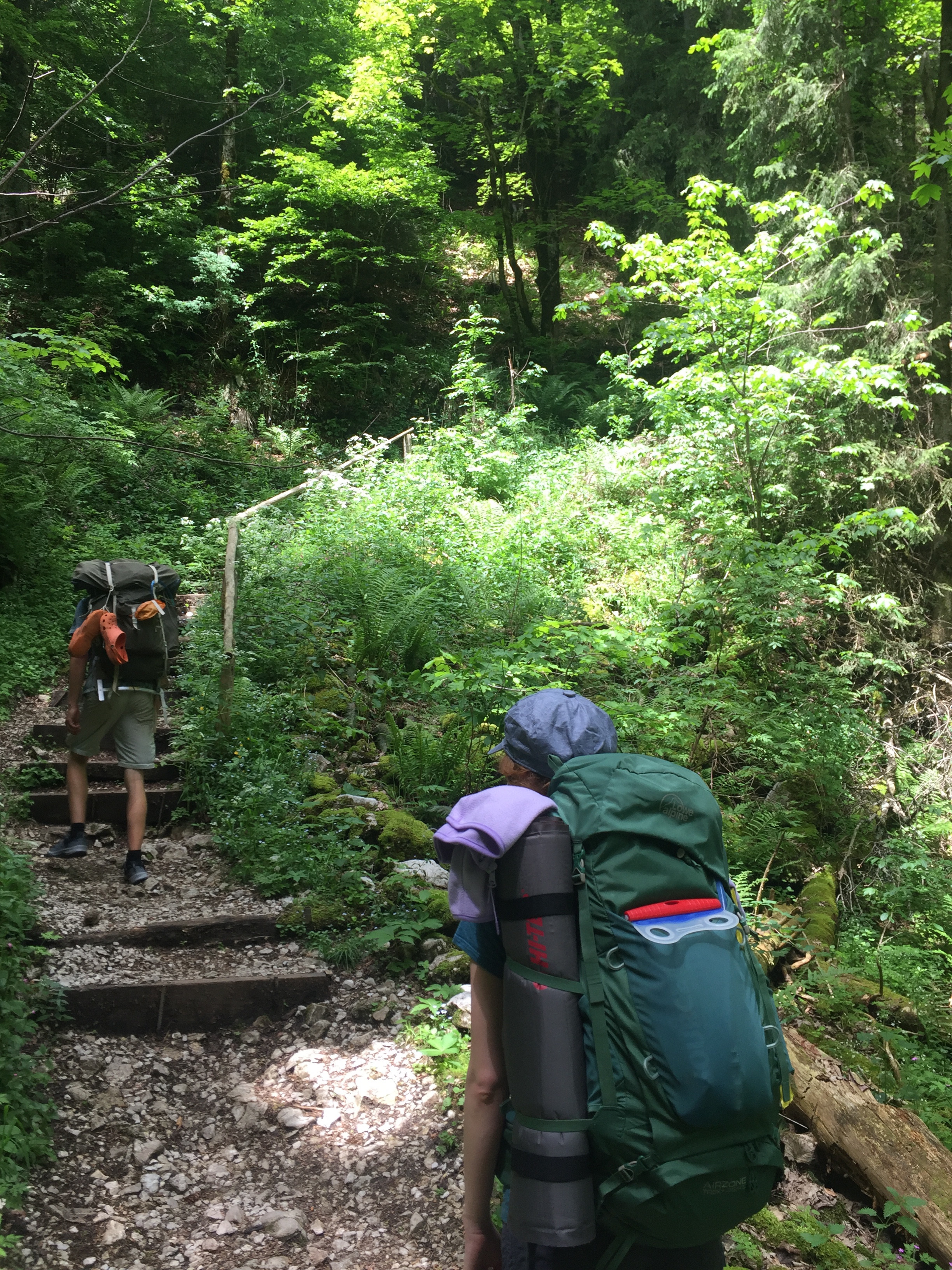
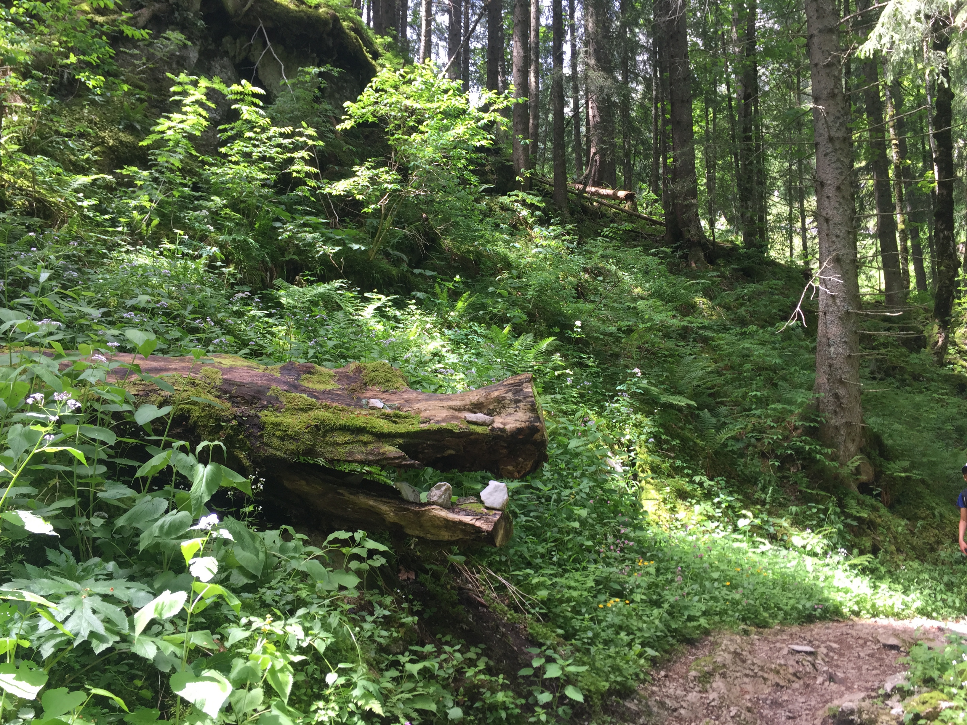
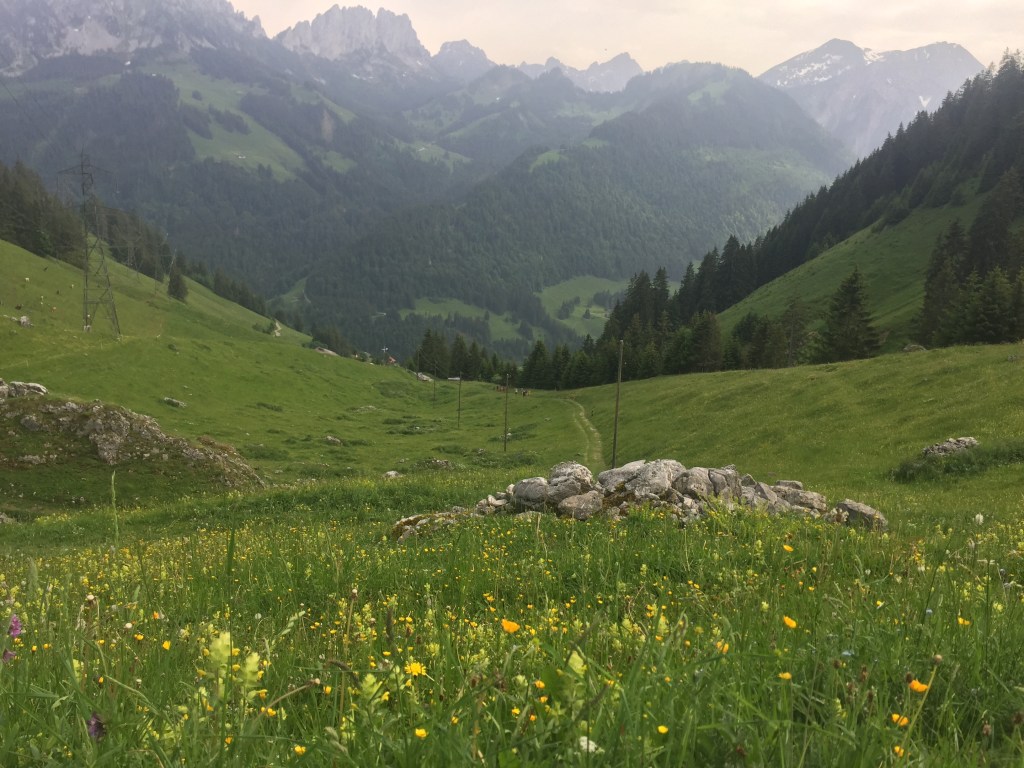
We followed the path next to the lake for a while, before we already started a gentle ascent on an asphalt road and soon thereafter entered a forest, which was an appreciated change of scenery, since the temperatures already got us sweating. The gentle ascent turned soon into a more steep climb on a little gravel road and stairs up through a thick shadowy forest. Noticing, that we all still have to find our groove and our rhythm again, we stopped for a first quick break and some snacks under the green cooling roof of the forest.
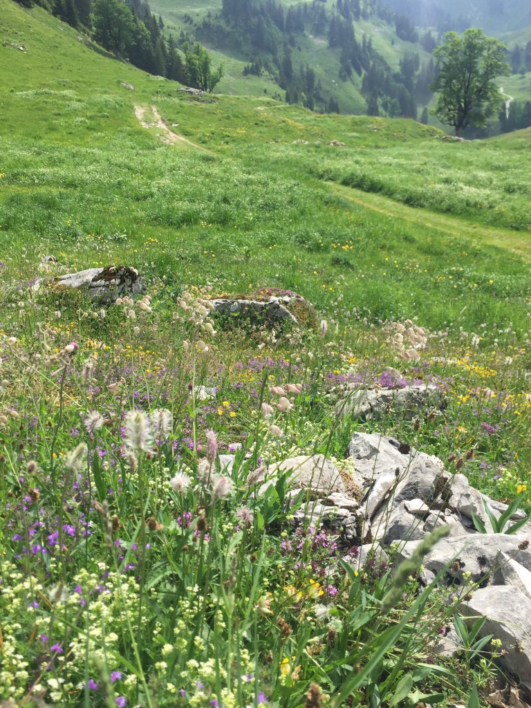
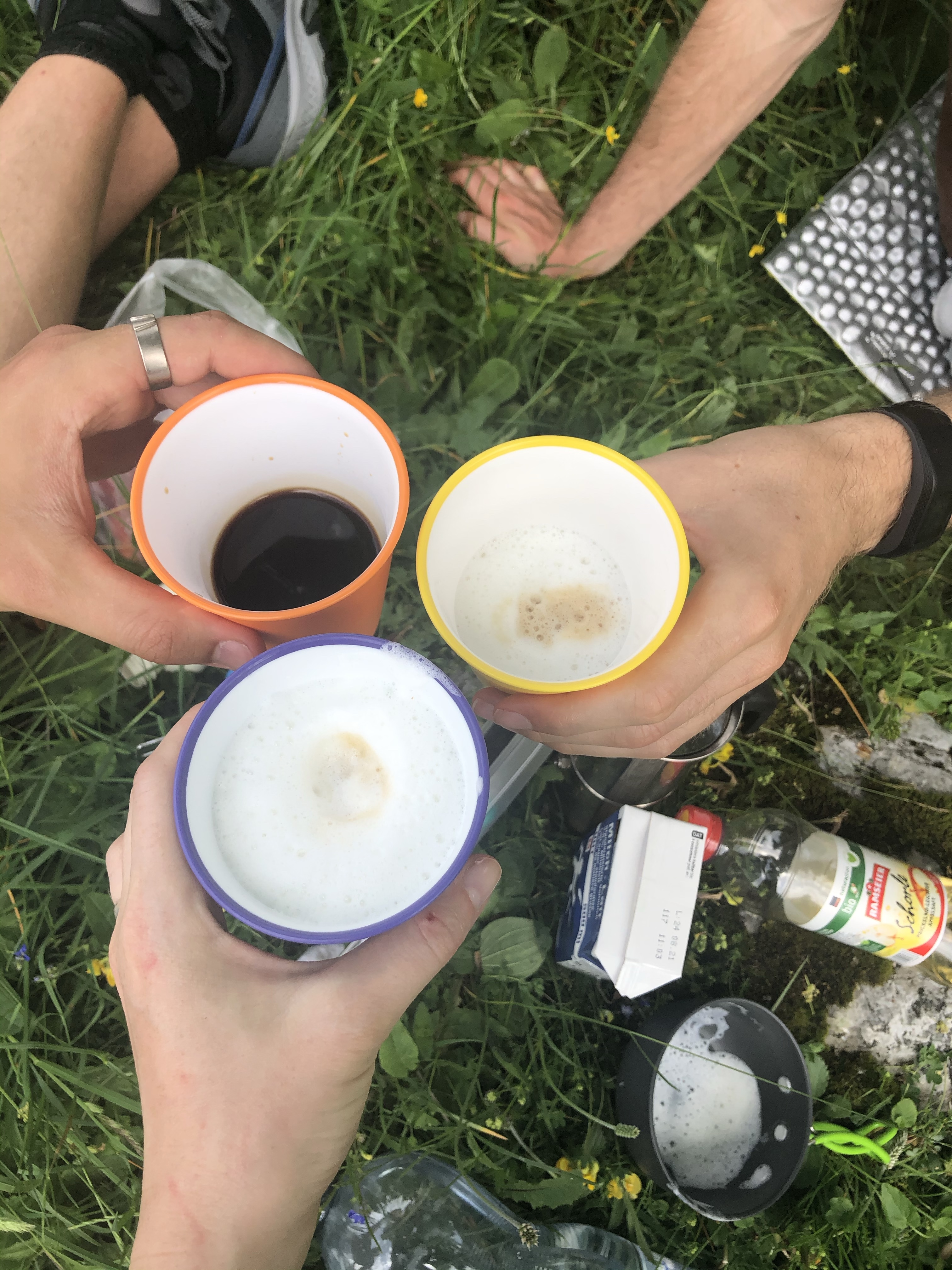
The ascent continued for about another 30 minutes, before we reached a wider gravel road and one of the many little alpine huts we would encounter on this section and were offered a first view of the “Brecca Schlund”, we would pass. The path luckily now stayed relatively even and allowed to regenerate after the short but intense climb from before and to enjoy this beautiful magical and wild alpine valley with its green pastures and flowers in all colors and shapes. It was really a little paradise and it would have been a shame to not take the time to enjoy it while sitting down and having lunch and a cup of coffee (nay Cappuccino, since we even brought a solar powered milk foamer).
It was easy to feel like Heidi or Peter , while sitting under a tree in a valley surrounded by mountains with snow tips and the sound of cowbells in the back round. An alpine panorama it was for sure.


We continued walking in the warm afternoon sun; the road continued to stay relatively flat, with very little ascent. When reaching “Rippetli”, we were surprised with a beautiful view of the Schwarzsee from above (which, I have to admit, had me worried for a moment that we somehow walked in a circle).
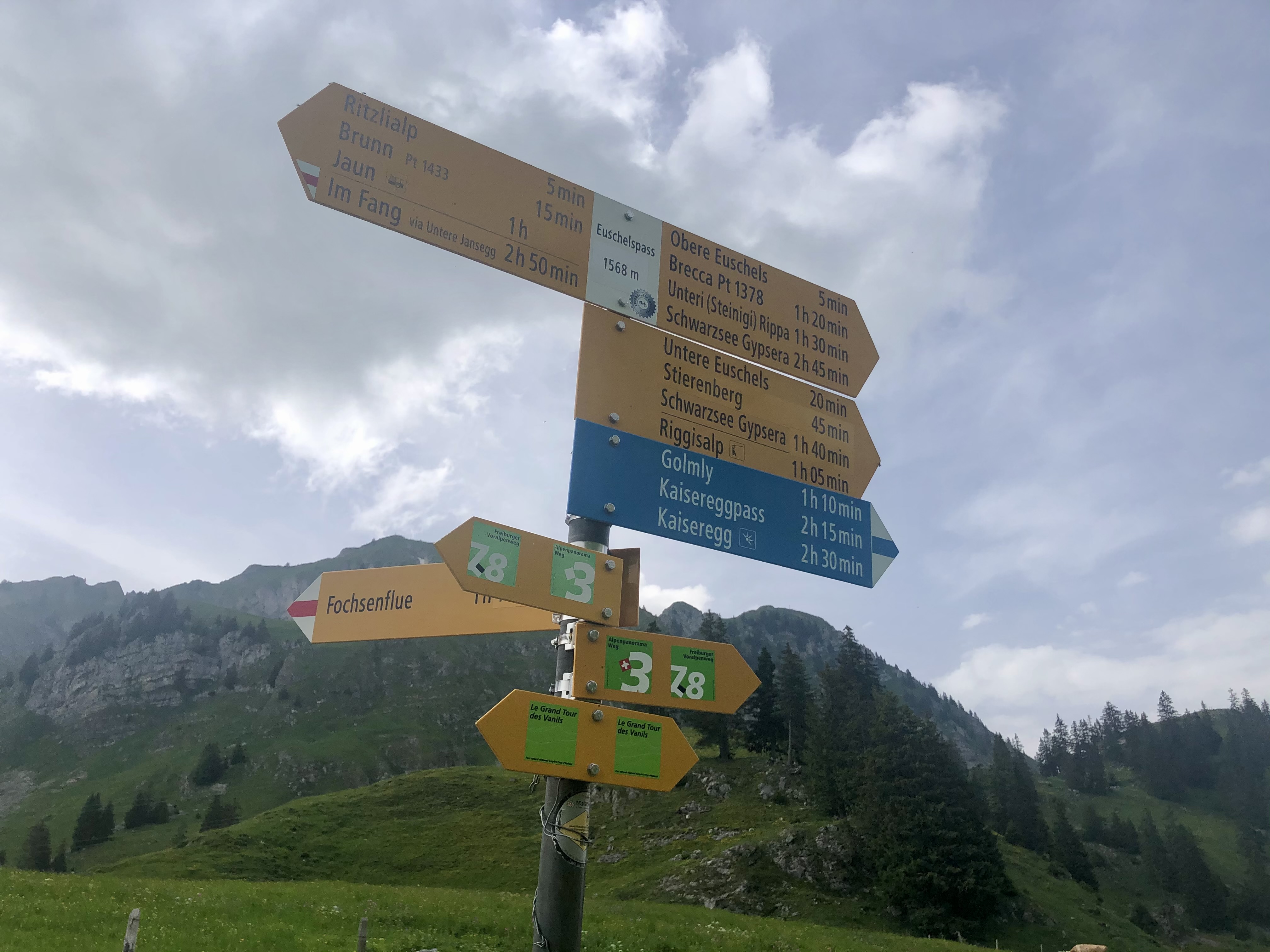
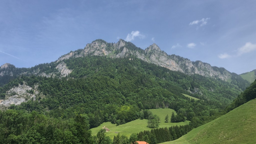
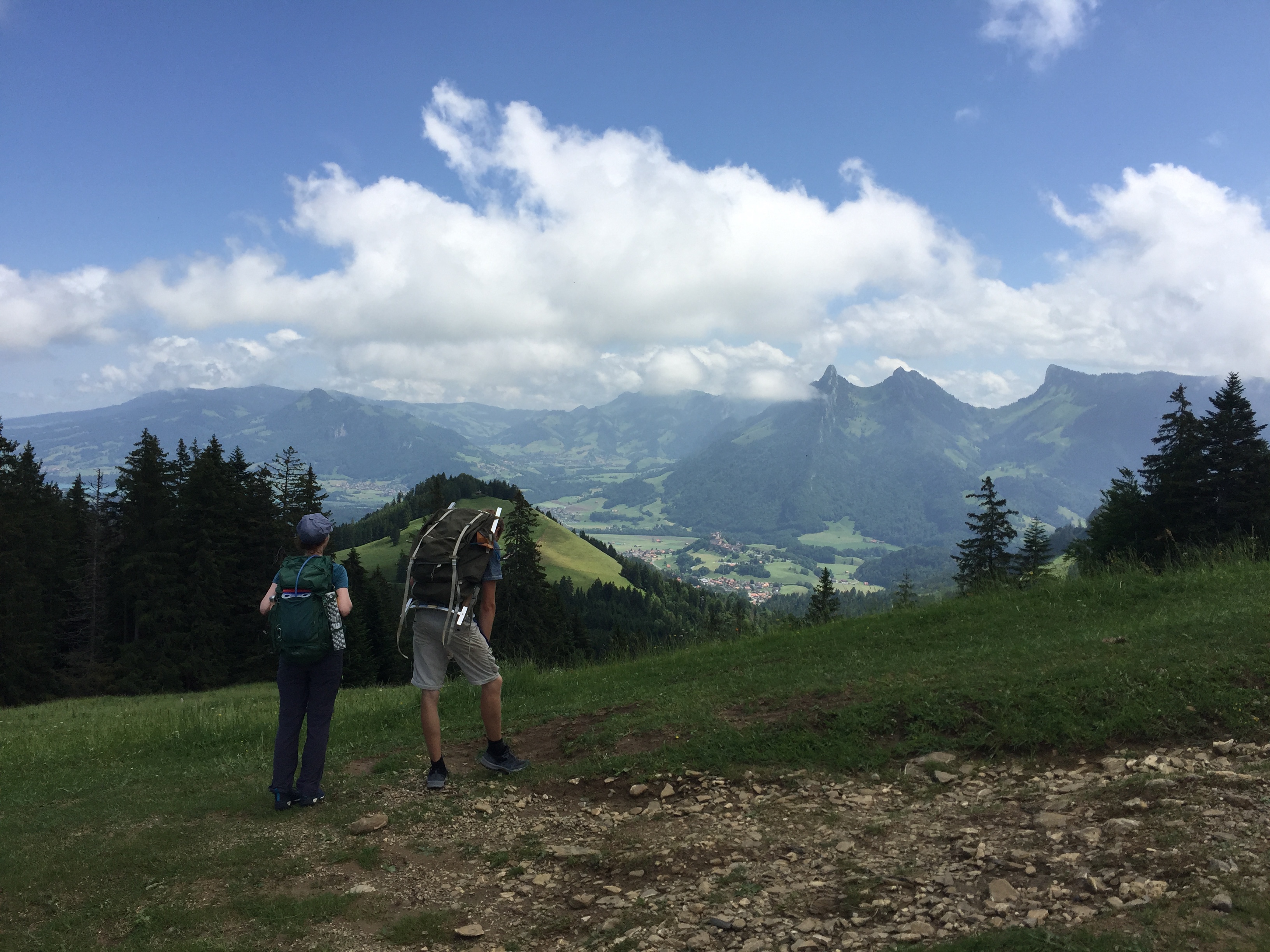
We continued with a little descent and a view of the Schwarzsee until the road made a bend to the right at “Stierenberg”, leading over a little bridge and some stairs on a narrow gravel road, always with a panorama of the massive rocks. From there it took us another half hour, passing by “Untere Euschels” and “Obere Euschels” to reach the “Euschelpass”, where we were offered an absolutely perfect view of the “Gastlosen”, a chain of prominent limestone rocks in the prealps. They have always fascinated me and it might sound a bit ridiculous, to say that it was like meeting a very intriguing person that I have always admired from a far distance. So I was very happy, that our descent faced those rocks, because I could not stop looking at them.
It said to be about another hour until Jaun, our destination for the night and we started to feel quite tired. So the little alpine hut “Ritzlialp” showed up just at the right time for a break with a Panaché and a Coupe Danmark.


The descent was quite nice, leading in a slalom path through the alpine pastures. If our feet wouldn’t already have been so tired, we probably would have skipped and jumped all the way to Jaun. But instead it was more a drag-and-fall kind of descent – especially for me, who on the last meters still fell and twisted my ankle.
At around 18:30 we reached Jaun, a little picturesque village, that I am sure, for a lot of people would be the perfect example of a “stereotypical” swiss village with its wooden houses, garden gnomes and swiss flags.
We stayed at the “Hotel Wasserfall,” right in the center of the village and close to the waterfall that gives the hotel its name. We were happy, that the restaurant served traditional meals for the area such as “Käseschnitte”, Fondue and Rösti, as they are all super rich and nourishing and most of all: delicious! With the gentle gurgling of the waterfall and a sky that slowly changed from blue to a mixture of rose, purple and lightblue we enjoyed good conversations, good food and the last hours of this adventurous day, before going to bed.


Click here to see this section on “SchweizMobil”
Day 2: Jaun to Gruyères
Waking up, I was a bit afraid that my ankle might still hurt or worse: hurt even more than yesterday. But I was relieved to not feel a single thing when stepping on it. Thus started the urge and excitement to start the hike.
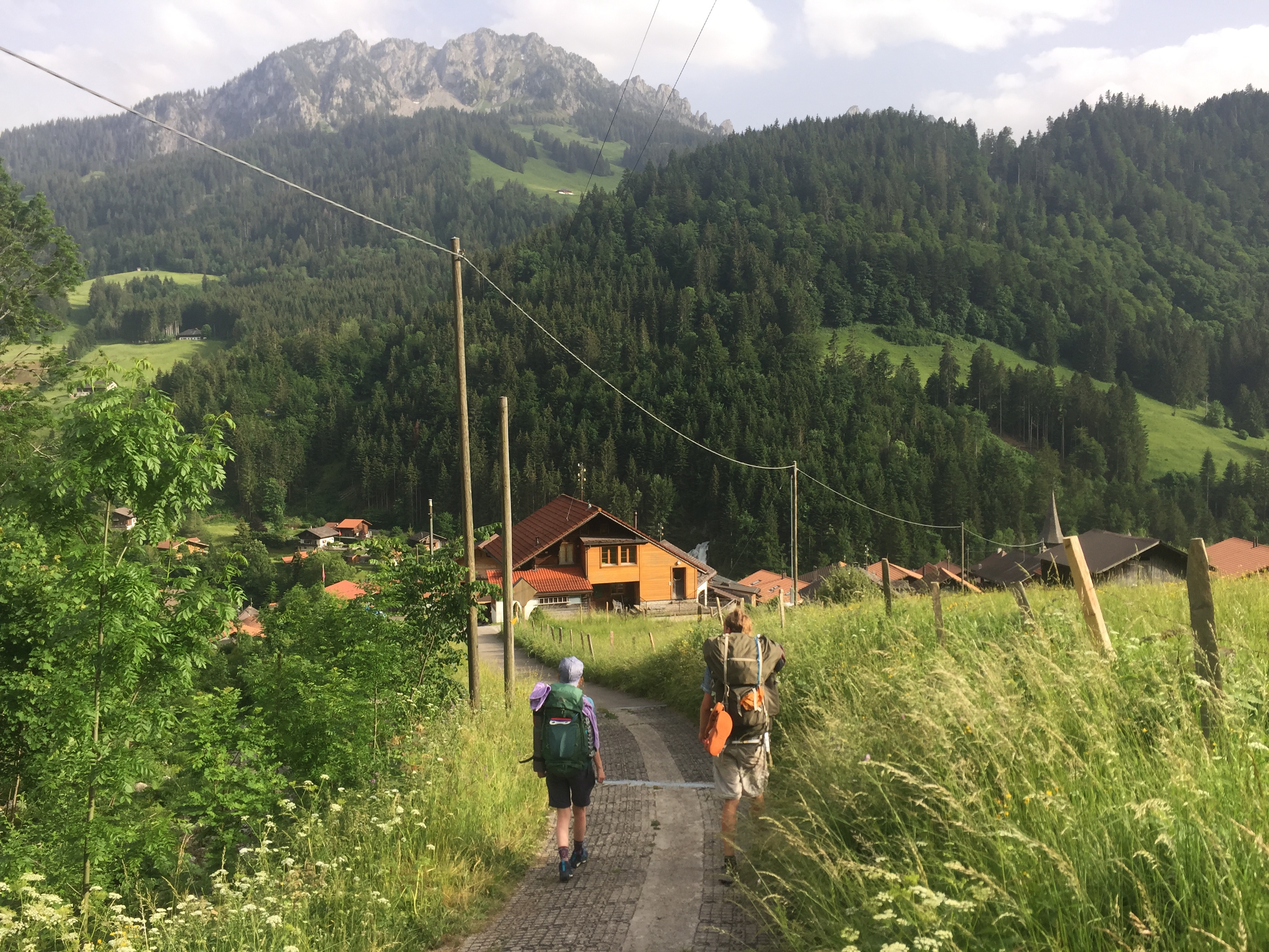
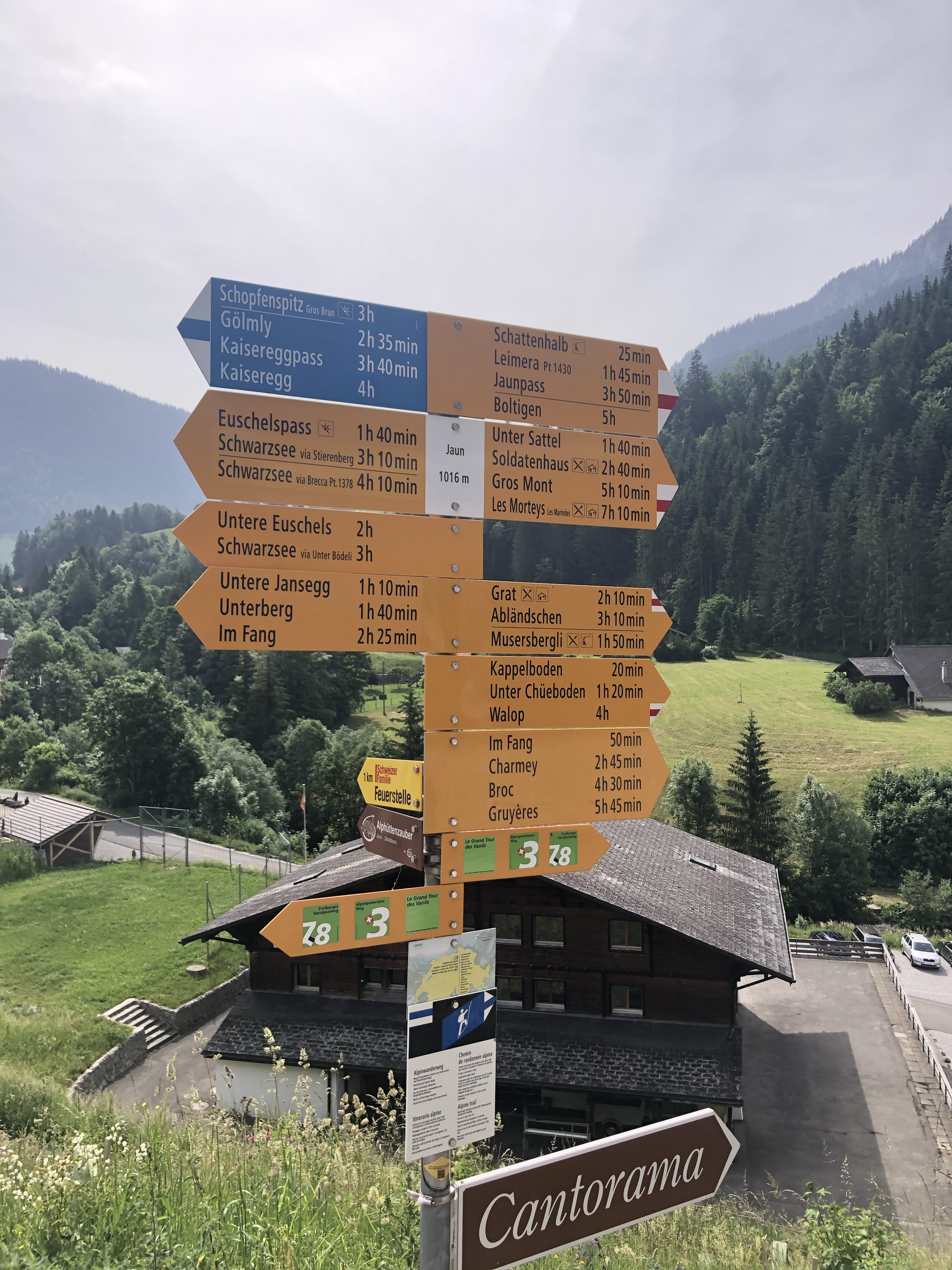
But being in a nice hotel that served us a delicious dinner the evening before, we did not want to miss out on the breakfast – which was equally delicious, especially the large selection of local cheeses of course. All fueled up we strapped on our backpacks and made our way to the big collection of hiking signs a little down the road. It was supposed to be a 5.45 hour hike to Gruyères. The weather was nice, a lot of sun, blue sky and some white clouds wandering above us. After passing by some old buildings and a church, we walked for a while next to Jaunbach, a relaxed calm start into todays section with the peaceful gurgeling water next to us.
It didn’t take us too long to reach a nice big field close to the water with an impressive view of the surrounding mountains that we hiked next to the day before, where we made already our first stop to have a coffee and some snacks.

The path, while nice and relaxing was in general not so impressive “view-wise” in comparison to yesterday. But the mostly flat, even road gave us the opportunity to talk and catch up on what has happened in the past months in our lives without being completely out of breath from walking 😊
At Sous les Vanels the path lead away from the Jaunbach through a little thick forest, a part of todays hike that we all very much enjoyed, feeling like three members of the Fellowship of the Ring traveling through Middleearth.
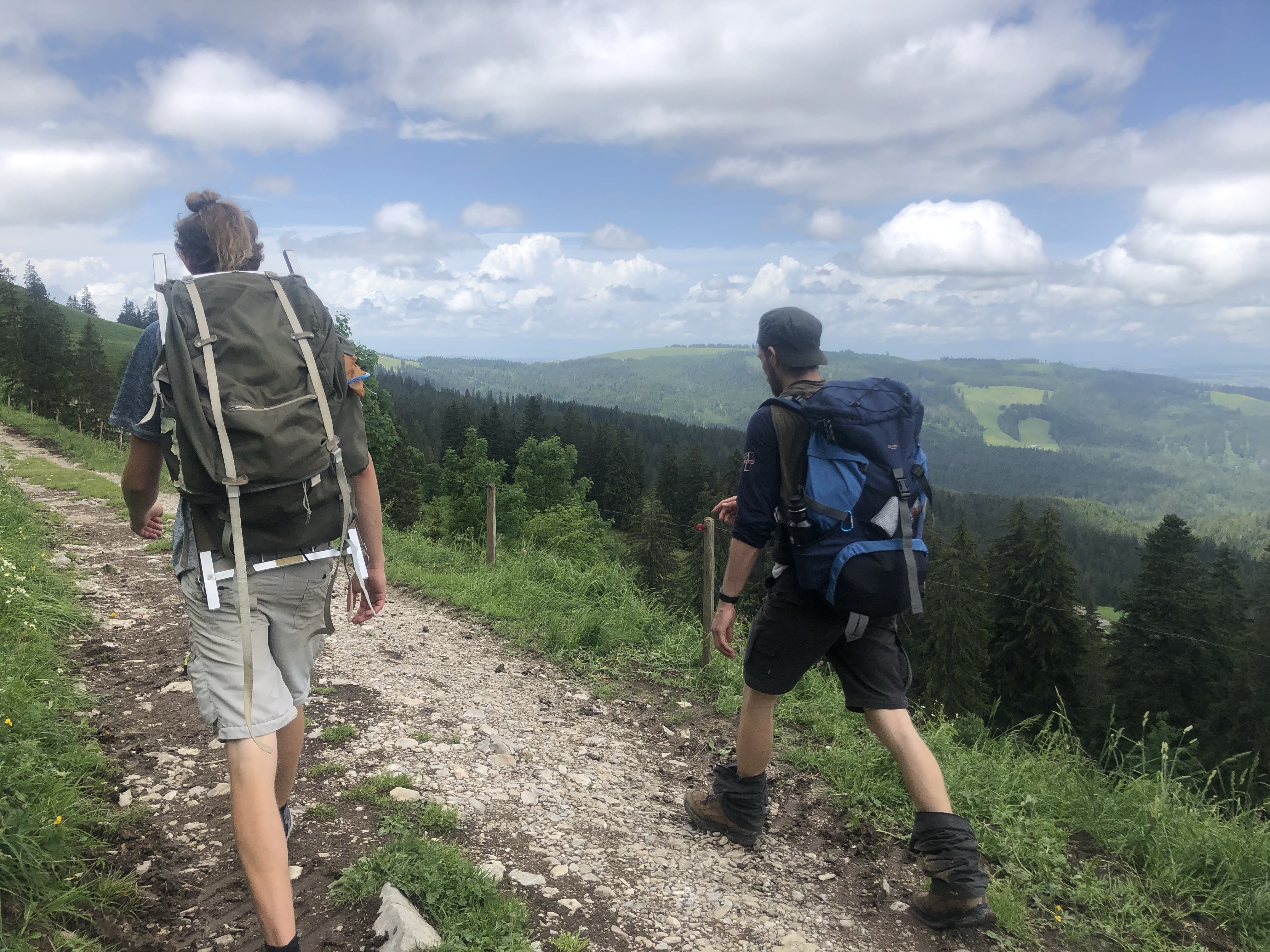
After a slight ascent and descent afterwards, we reached the first houses of the village Charmey (which we, as we jokingly said, didn’t find all that charming). The location of the village is beautiful though with amazing views every way you turn. And after having encountered a vending machine that sells Fonduecheese, there was also no doubt anymore that we where in the district of Gruyères. From Charmey the path led through the suburbs out of the village and into a forest that seemed to be a popular spot for people from around to go walking and jogging so it was quite busy. In the distance we saw some dark clouds forming and still joked that it felt a bit like walking towards Mordor (I assume in the meantime it has become clear, that we are Lord of the Rings Fans?) but thought nothing of it.
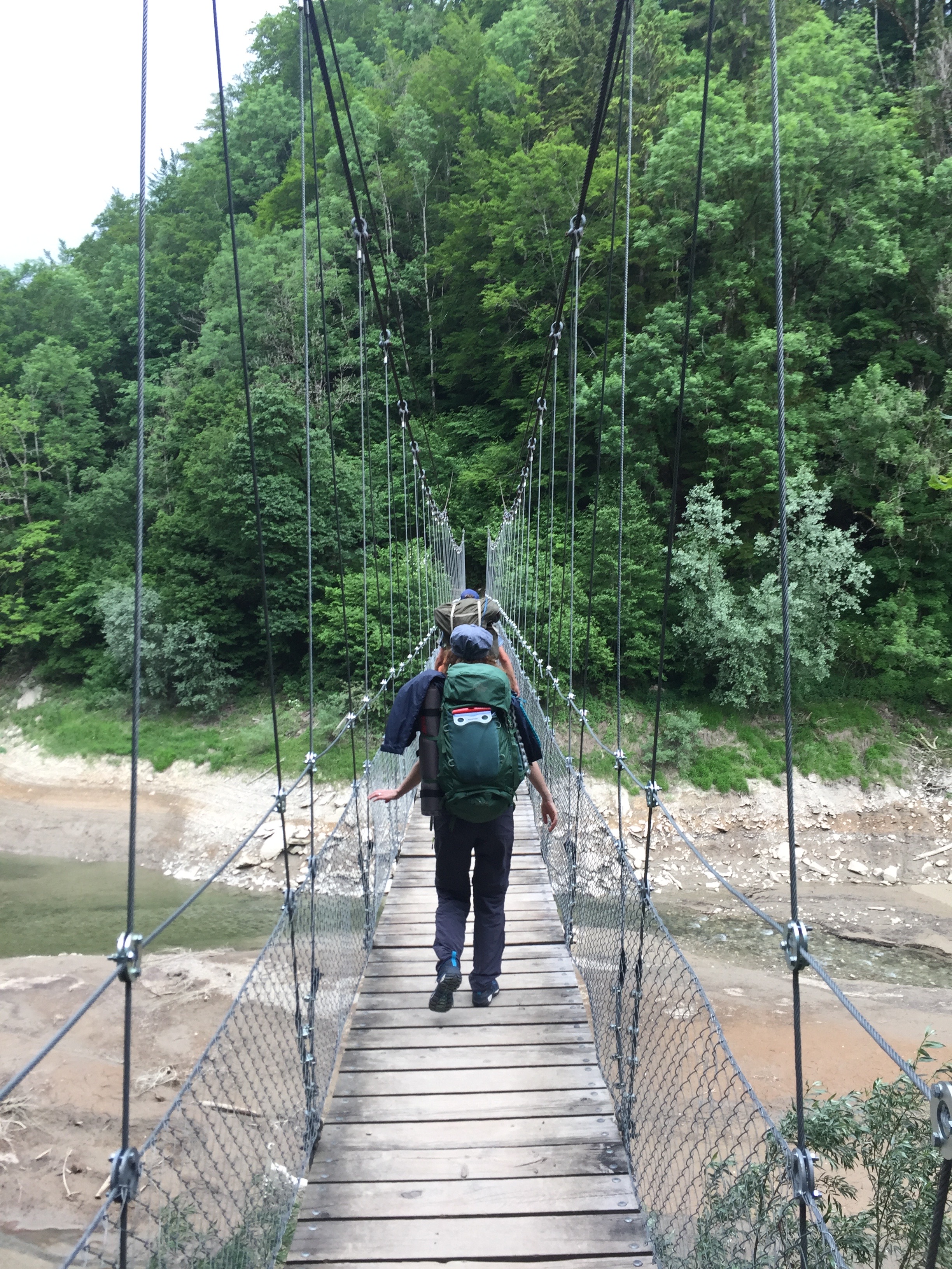
Crossing the Lac de Montsalvens (which due to its low water levels barely felt like a lake) via an approximately 60 meter long swinging bridge was the first moderate challenge for me today; but it was luckily over in a minute and the bridge is not high up – so it is very doable, even with my level of fear of heights. A narrow gravel path led above the lake through the forest and brought us to our lunch place under a roof of branches and leaves, sheltering us from the first raindrops. Hiking in rain is ok, eating in rain: not so much.


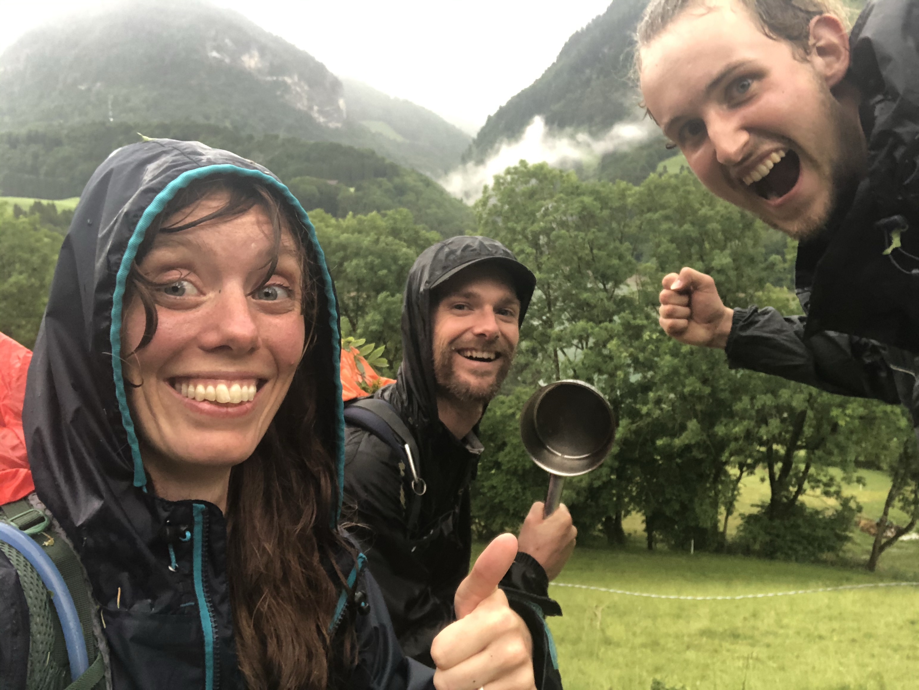
Having barely finished our meal, thunder started rumbling in the sky and a strong wind blew through the trees. As soon as we were done packing away all our things and wrapped our backpacks in rain protection, hail started to come down hard and in large amounts. In barely any time, the path above our Picnic place was covered in hail and people started running in all directions. We first hid under a couple of young trees but grew restless as to be so exposed and close to a now suddenly fast rising river. So we decided to make a run back to the village of Charmey, where we suddenly realized, that crossing a bridge full of metal wires in the middle of a storm with lightning is maybe not the smartest idea. So we ran back to the Picnic place in the hopes to hide under the table which turned out to be way too small for three people so it was back under the little trees, where we stayed, in a circle looking at each other, waiting for the storm to calm down and hoping it would not be much longer. I remember getting that surreal feeling of “this might be the end”. This helplessness was truly paralyzing and at the same time weirdly invigorating.
As soon as the hail stopped, we continued onward on the path, stepping over fallen down trees and branches, wading through hail, all the while keeping an eye out for injured people (luckily there was no one). At one point we encountered a couple with a dog, who told us, that the path further on was blocked and not safe to pass through. It seemed like a godsend, that right at this point, there was a path up to the main road, where also a busstop was supposed to be.
The scenery was magical, with the low clouds slowly rising through the valley over the now calm water. No more than 10 minutes later we sat in a very full bus that drove us direction Bulle, where we wanted to take another bus to Gruyères. Driving through little villages and over fields, we suddenly spotted the castle of Gruyères in the distance and in a spur of the moment decided to get out of the bus, right as the sun came back out as well, in the village of La Tour-de-Trême and still hike the rest to Gruyères. Of course we didn’t follow the Alpine Panorama Trail anymore. But the mountains still stayed in sight for a large amount of the way. We let the warm sunshine dry our hair and clothes, with only our shoes and socks remaining soaked for the remainder of the hike.

The path led us through the village of Le Pâquier and continued on to Pringy, from which it was not much longer until we reached the trainstation of Gruyères. From there we reached the old town via a short ascent.
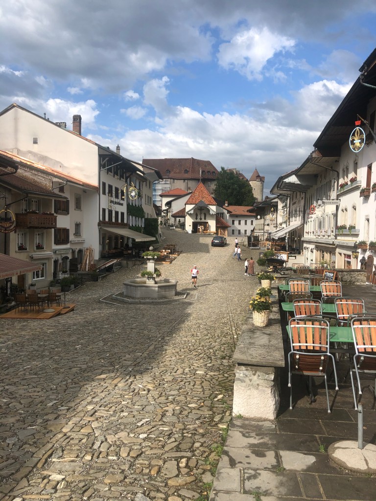
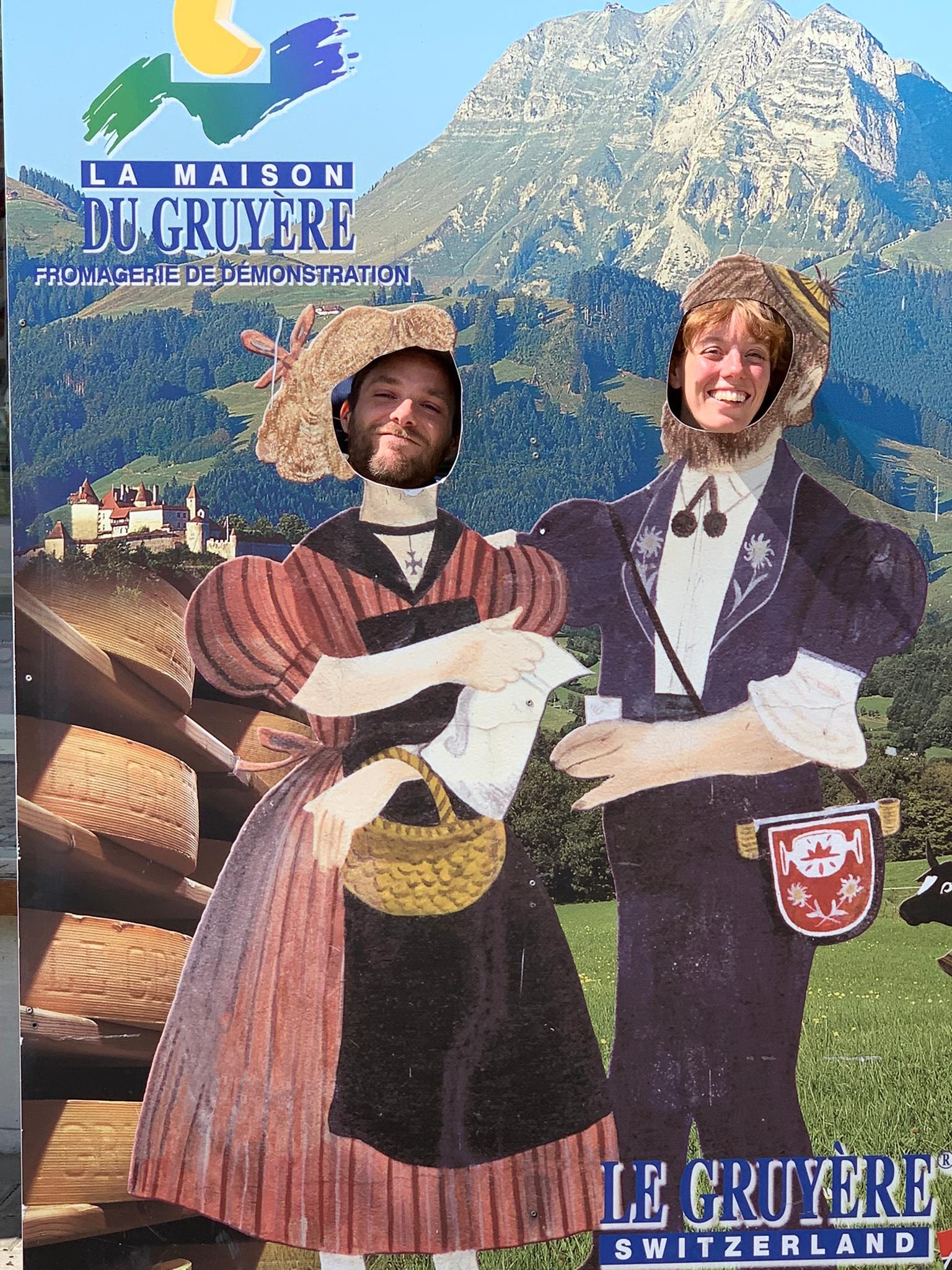
The old town, which consists basically of one street was an absolutely lovely sight. Were it not for all the regular dressed people, one could have easily thought to have been transported to the medieval times.
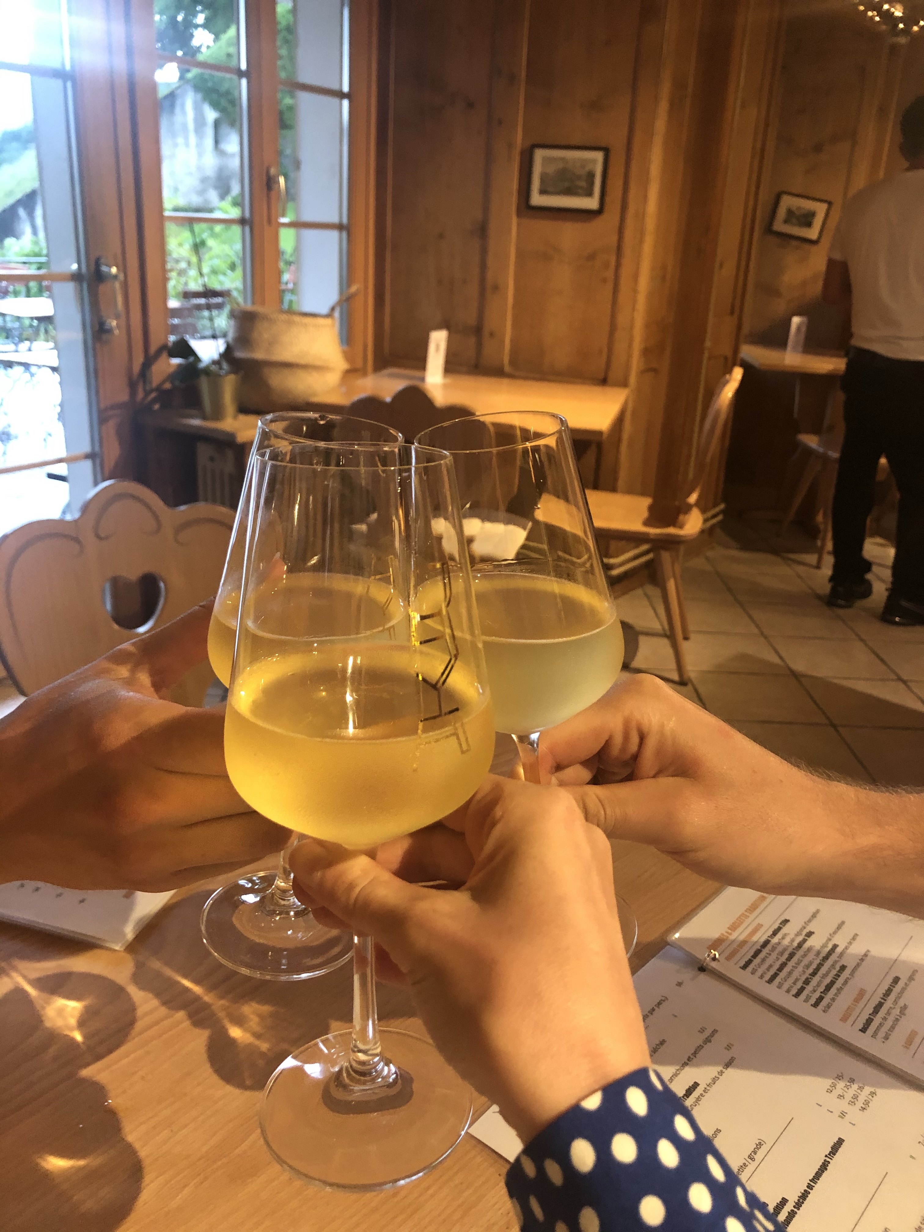
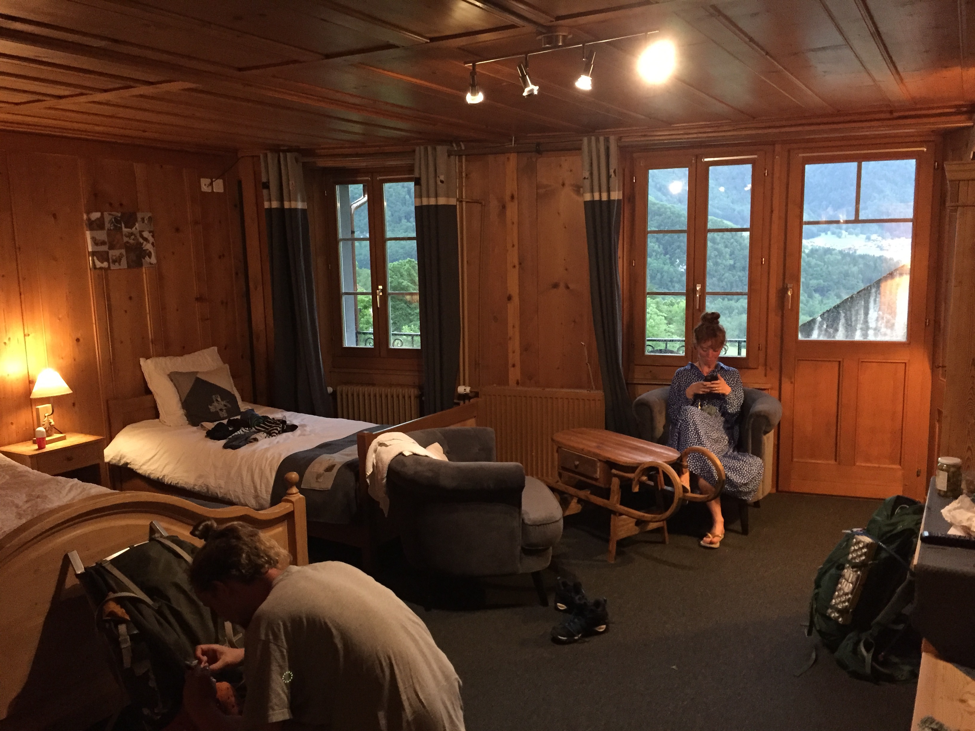
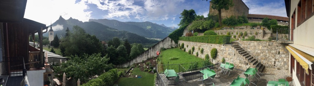
Our hotel, “Gruyère Rooms” was right in the historical center and easy to find. Upon checking in, we learned that we had been upgraded and were now in a bigger room with a balcony and a view over the hotel garden and the mountains. The rooms were decorated with traditional wooden furniture and had an all over warm and cozy design. After a well needed shower and a change of clothes, we went to the neighboring restaurant for dinner. As tradition demands it when in Gruyères, we ordered Fondue and white wine and Coupe Danmark with Meringue for dessert. It was all around delicious and let the day end on a very satisfying note.

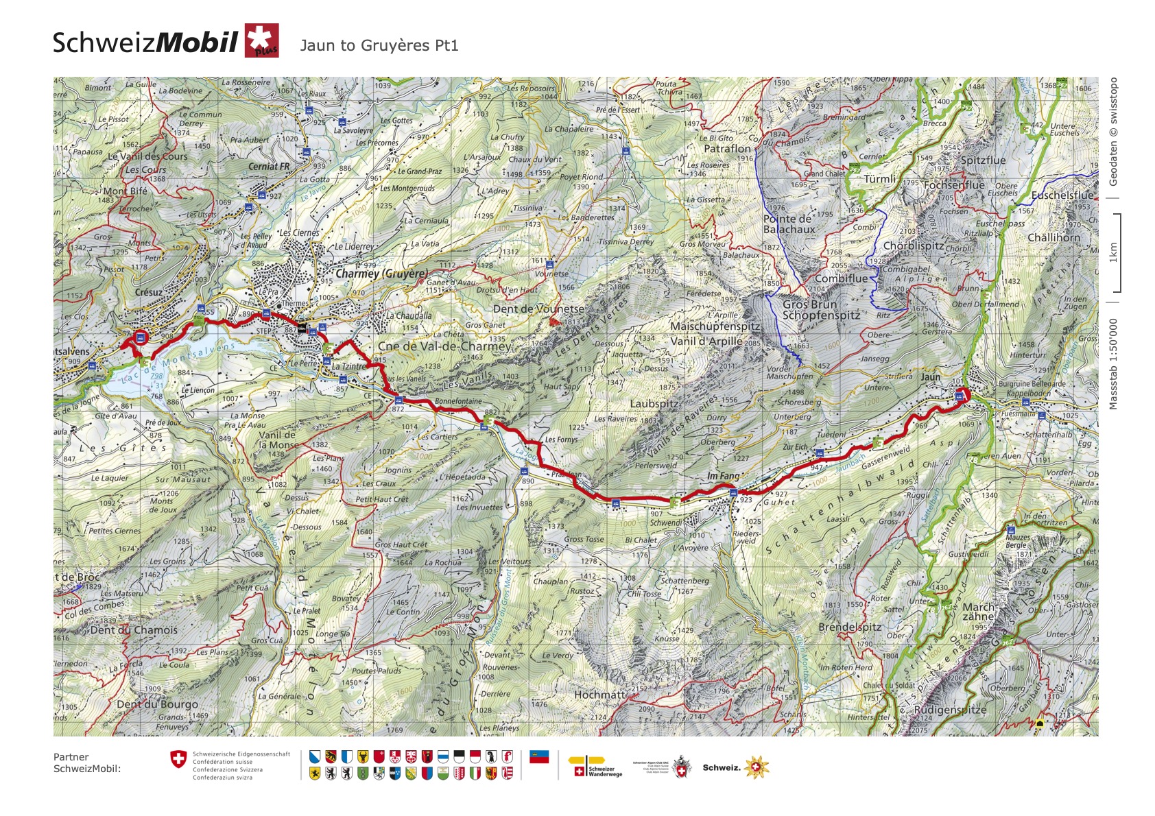
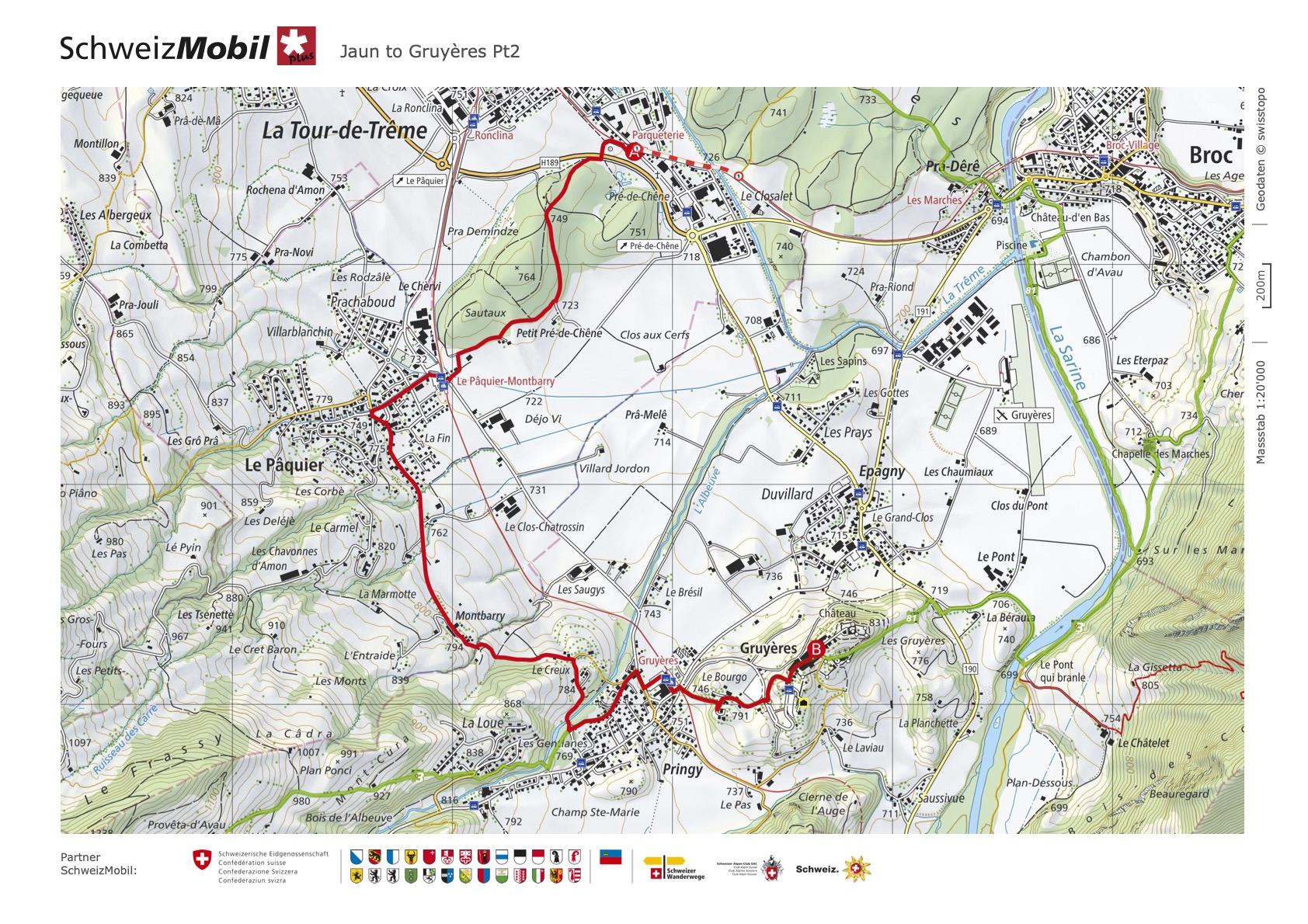
Click here and here to see the two parts of this section on “SchweizMobil”
Day 3: Gruyères to Les Paccots
The next morning started with sunny weather, a breakfast and the big question: do we continue with the hike to Les Paccots or is it too risky? After yesterday we were definitely more careful and wanted to avoid another apocalyptic situation. But checking out the route and some of the pictures, it just looked too tempting to just stop, so we decided to go ahead as planned. This would be Joris’ last day hiking with us, Sam and me originally planned to stay on a camping in Les Paccots and then hike the following day from there to Vevey (the last section of the Fribourg portion of the Alpine Panorama Trail). Given the weather, we were both not so keen on spending the night in a tent though and we decided to prolong our stay in Gruyères for one more night and take the bus/train back from Les Paccots and see the next day, what the weather allows us to do.
To avoid running into bad weather, which was predicted for the second half of the day, we chose to hike the whole section without any breaks and kept our weather-radars ready to check regularly as well as possible mountain huts to find shelter in case of an earlier weather change.
We started the hike with blue sky and sunshine down at the Gruyères train station. After passing the little village of Pringy, we crossed the river Albeuve. The effects of the storm of the last day were visible; in the high rise of the river as well as in fallen trees and damaged houses and streets. After crossing the river, we started the first steep ascent in the warm morning sun. The view was impressive every time we turned around and looked back at where we came from and it would have been easy to get lost in admiration. But the low hanging dark clouds in the distance where a reminder, that time was of the essence and we continued on.

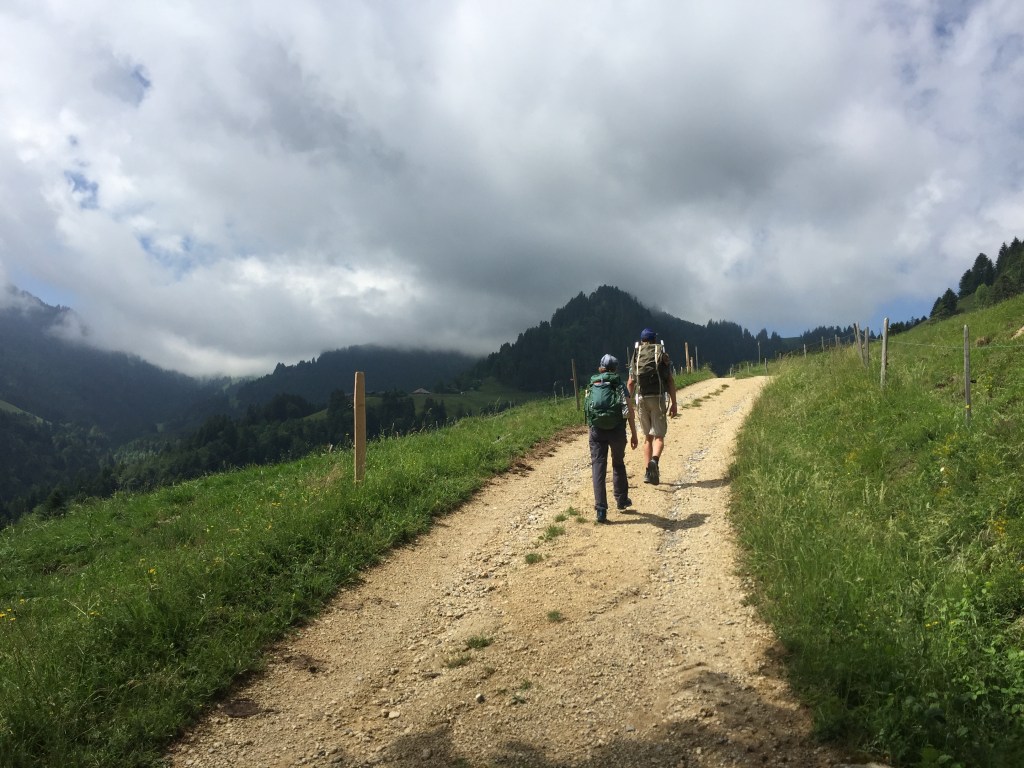
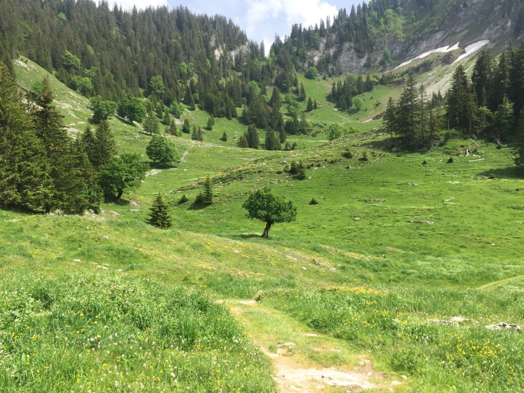
The path mostly lead over vast alpine pastures or consisted of wider gravel roads. I was fascinated, how I could feel so high up, enjoy such amazing views and yet not feel scared because of the height for one second. The pre-alps surrounding us looked like a painting, so magnificent and impressive, the sun and the wandering clouds creating a magical play of light on the green pastures, constantly changing the atmosphere. While the hike was partially pretty steep, it was always intermittent with even sections that allowed us to look back on the already achieved and enjoy the views. If only for a second.
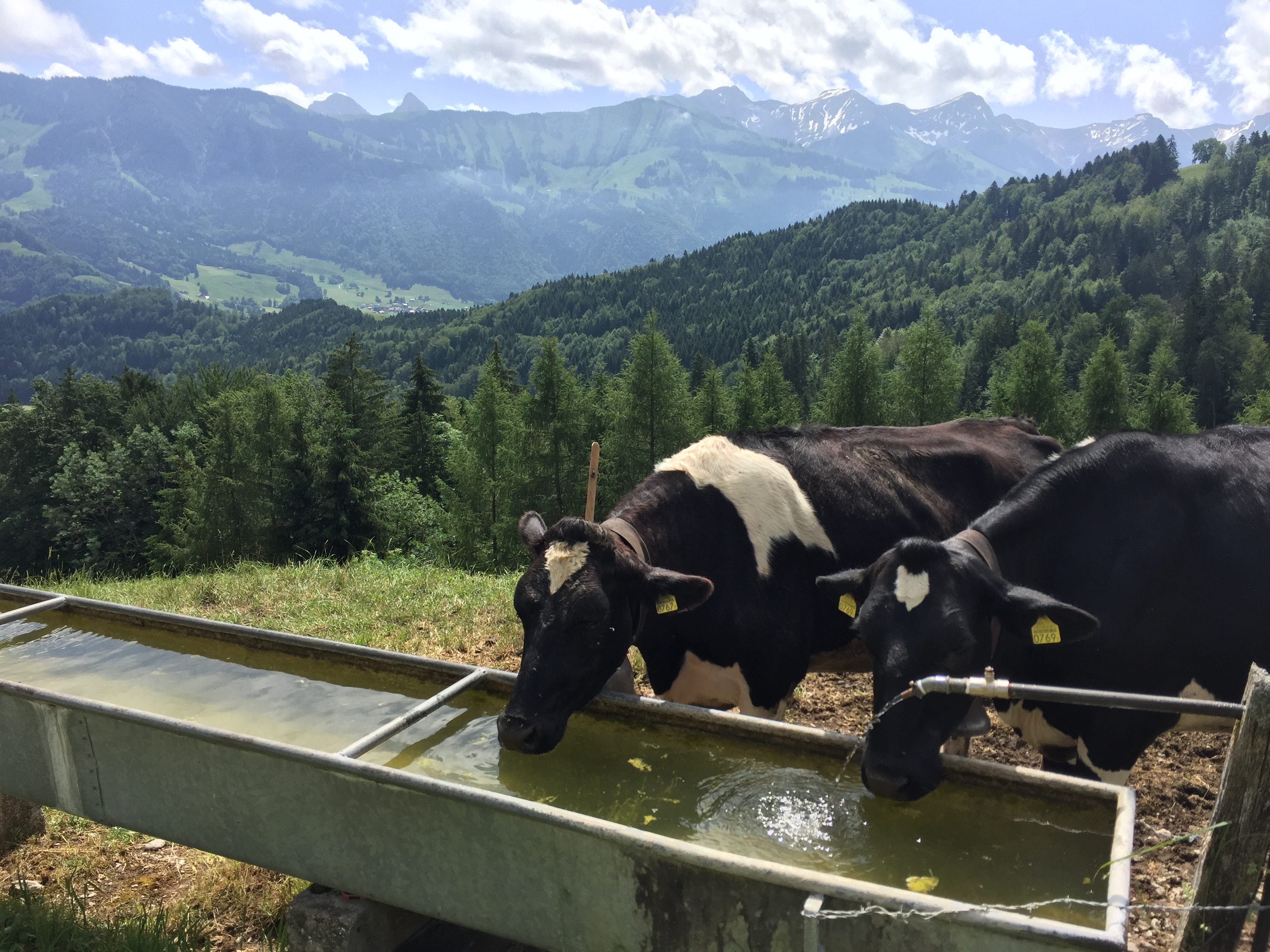
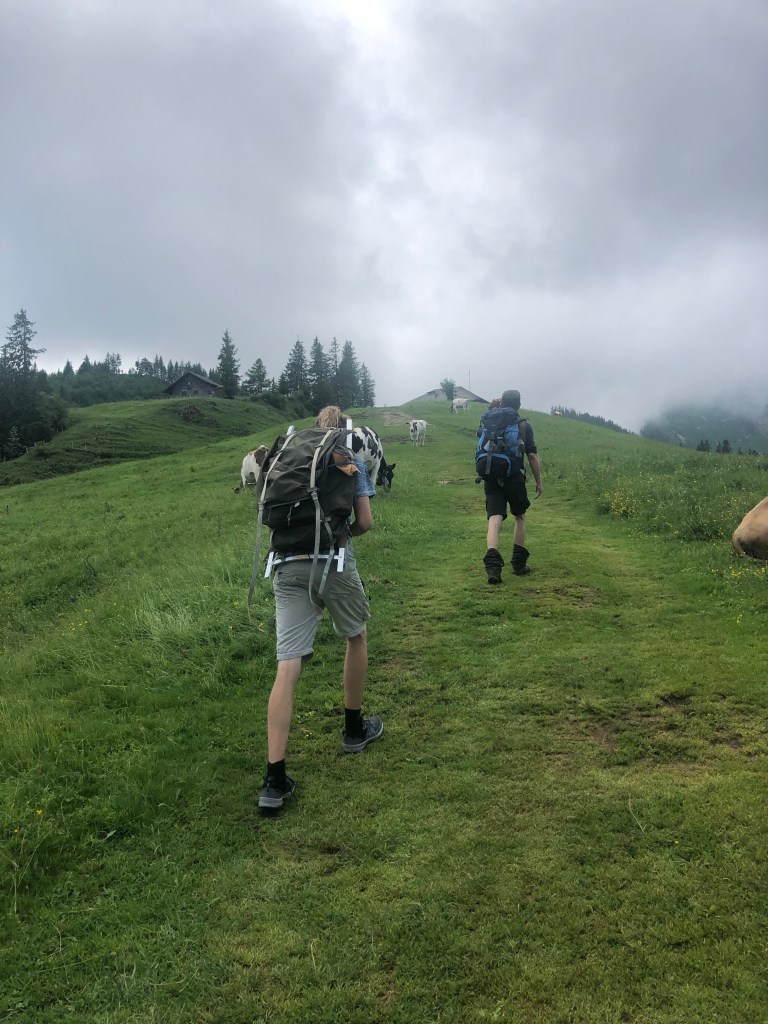
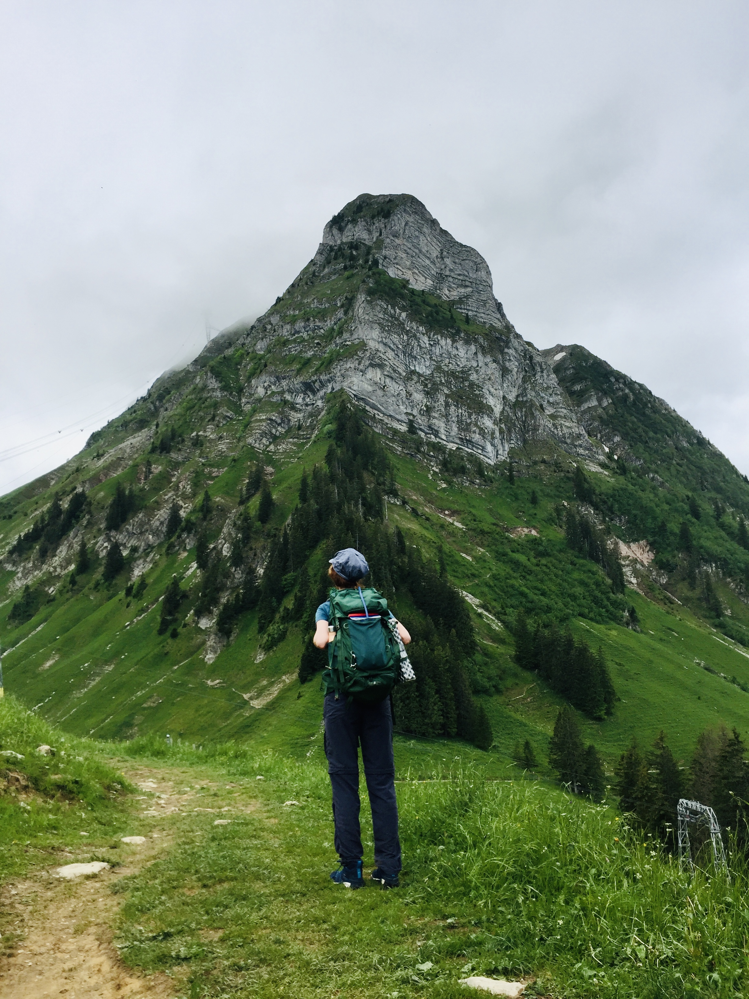
After another hour of hiking and some very intense climbing and some stare-down-encounters with curious cows, we reached Plan Francey and the Moléson, a 2’000 m high mountain, that can also be ascended. At the foot of the mountain was a restaurant as well as a cable car station that would take you to the top of the Moléson; due to the stormy weather it was closed for the day.
Standing at 1519 meters at the bottom of this impressive mountain, I was again reminded, why I ultimately want to overcome my fear of heights.

The path lead around on the right side of the Moléson, allowing us to admire the impressive mountain massif some more, while also offering a view of the Lake of Geneva, the Jura and the Pre-Alps.
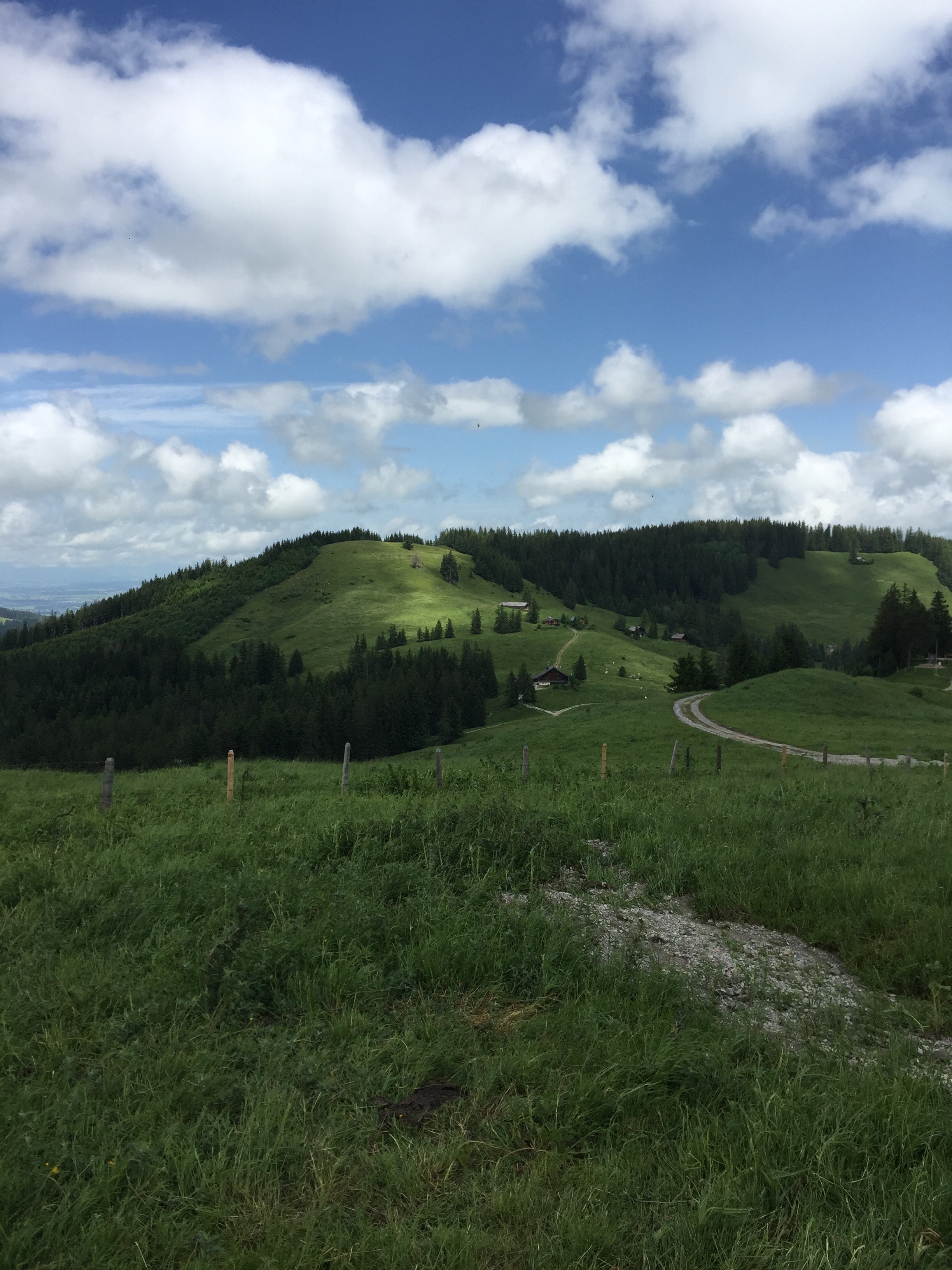
After leaving the foot of the Moléson behind, the gravel road passed by some huts and largely led over fields through thick grass, covered with little flowers. The mountain massifs, the vast blue sky with large wandering clouds made us feel so small and insignificant; tiny visitors in this big nature -“auditorium”.
While I am usually not a fan of time pressed hiking (I know that to be a sport of sorts for some hikers), there was a certain thrill to looking back on the path, seeing the dark clouds gathering and speeding up to make sure that they won’t reach us.
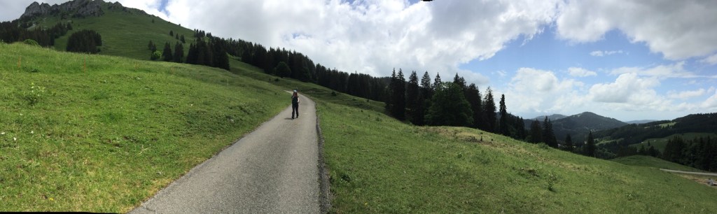
A large part of the descend direction Les Paccots led over an asphalt road, that wound its way down to the valley. In terms of heights or being exposed there was nothing to worry about, which always is a relief when facing a descent. And even though there were many signs of civilization; the road, the occasional house or little restaurant, we felt like we were alone with nature – nothing to rip us out of our hiking-experience yet.
The last bit of the path led through a little peaceful forest, bevor ending up on the main road and entering the village of Les Paccots, a place where we rather fast came to the conclusion, that it is not a place to stay for too long as it was rather “un-cozy”. Still we enjoyed something to eat close to the busstop, while listening to the thunder rumbling in the air.
A bus took us to Bulle, where we said our goodbyes to our hiking buddy Joris who started his journey back home. As for Sam and me, it was back to Gruyères, our cozy room with a view and a delicious Pizza for dinner.


Click here to see this section on “SchweizMobil”
Day 4: Gruyères to Bulle
The next morning, Sam and me decided to make it a short hike and walk from Gruyères to Bulle and see, if and where we go from there. The path followed the first section of the 3 section hike “Fribourg en diagonale”. The route is rather unimpressive (maybe we were also just very spoiled from the last days) but a perfectly comfortable path to reminisce about the past experiences.
For a large part the path follows the river Sarine, before passing the village of Broc (where they make the delicious Cailler Chocolate). After that the route led us through the forest of Bouleyres on mostly wide gravel roads. Upon exiting the forest, one directly enters Bulle, the second largest city of the canton Fribourg.
As Sam felt the painful effects of his -not particularly ergonomic- backpack rather strongly, we decided to take the train in Bulle and head home. It was a perfect finish to a perfect four days full of adventure.
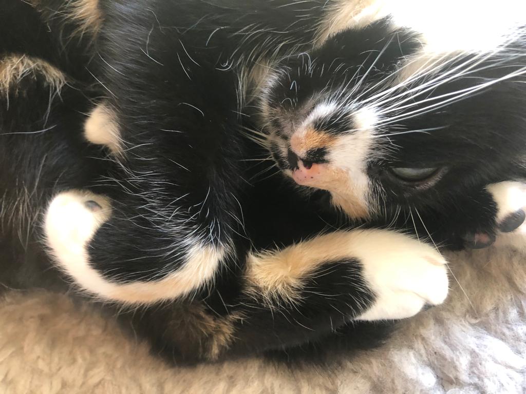
The day ended back home with our cat Yuki, a good bowl of Pasta and the World Championship football match between the Czech Republic and England.

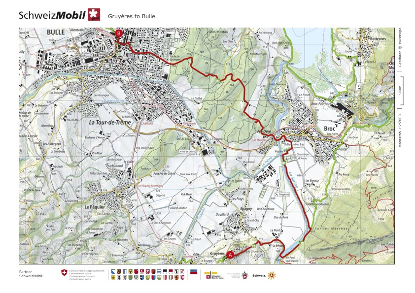
Click here to see this section on “SchweizMobil”
As someone who loves to have a vast view and feel like I can touch the sky if I only stretch a little more, this hike was everything I could hope for. It offers some of the most amazing and impressive views and so much diversity while walking. The little villages and mountain restaurants one encounters add a lot of charm and authenticity to the experience, while still keeping the feeling of being in uncharted territory. The sections, while at times challenging in length and/or altitude, never felt like “too much” and I can safely say, that for me, there was not one moment where I felt unsafe (well at least concerning heights 😉). Those days in the “wilderness” of Fribourg made us truly three very content Hobbits filled with many irreplaceable experiences😊.


Route overview
- Duration: 3 – 4 Days (depending if you stop in Les Paccots)
- Total distance: ~ 59.8 km
- Total ascent/descent: ~ 2’336m/2’218m
- Highest point: 1’567m at the Euschelspass
Day-by-day breakdown
| Day 1: Schwarzsee to Jaun | Difficulty: T1 (Hiking Trail) Length: 12.89 km Duration: 4:21 h Ascent/Descent: 749m/778m |
| Day 2: Jaun to Gruyères | Part 1 Difficulty: T1 (Hiking Trail) Length: 14.57 km Duration: 3:47 h Ascent/Descent: 271m/422m Part 2 Difficulty: T1 (Hiking Trail) Length: 5.95 km Duration: 1.37 h Ascent/Descent: 202m/119m |
| Day 3: Gruyères to Les Paccots | Difficulty: T1 (Hiking Trail) Length: 17.17 km Duration: 5:23 h Ascent/Descent: 954m/699m |
| Day 4: Gruyères to Bulle | Difficulty: T1 (Hiking Trail) Length: 9.23 km Duration: 2:20 h Ascent/Descent: 160m/200m |
Some more useful facts about this hike
| Best season: This is a beautiful Summer hike. While I could imagine that early Autumn might also be very nice. Just be mindful of the snow conditions which are sometimes earlier in the mountains. Even the pre alps. |
| Trail exposure: Minimal. This hike really and truly poses no challenges except maybe for the hanging bridge on day 2. |
- The waterfall in Jaun is only about a 5 minutes walk away from the “Hotel Wasserfall” – so a perfect little evening stroll.
- If you have an extra day available, you could do the section 2 of the “Freiburger Voralpenweg” (which is a T1 hiking trail), which takes you very close to the Gastlosen and then just turn around and walk the same route back. We didn’t do that but I intend to on my next visit!
- The part of the 2nd day that we missed would have been another 2 hours 18 minutes and is supposed to be very nice along the Lac de Montsalvens.
- When you see clouds that remind you of Mordor, stop or at least interrupt your hike.

Leave a comment