

From La Brévine to La Cibourg in 2 days
August 2019
This was my first time exploring the area around La Brévine by foot; so far I only knew it from trips with the car and remember to always have longed to just get out and start walking. Vue des Alpes however, though I knew to have been there as a child, I bore no memory of; this is sometimes like meeting a Kindergarten friend again when you are an adult – you seem to have a vague idea how the looked but are curious to see, if they have changed since then. Basel was on a record high in terms of heat – so I was very happy to leave the city behind for two days, to head to Switzerlands Siberia 🙂
Day 1: La Brévine to La Sagne
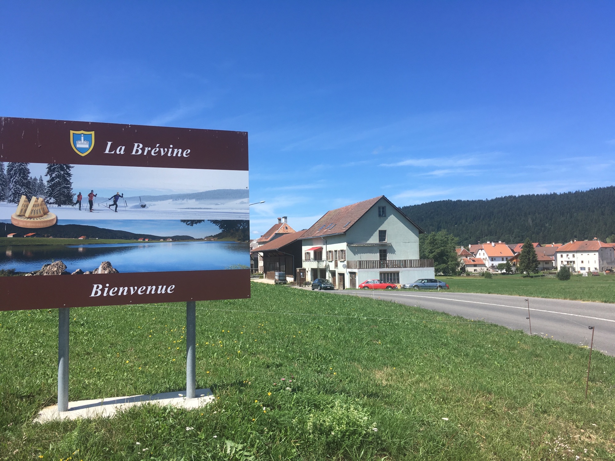
On a warm August morning I made my way to La Brévine, which from Basel is quite a journey and requires several changes of trains and buses. The bus drive from Le Locle to La Brévine was already beautiful and I could not wait to get out. I was not the only eager hiker to exit in La Brévine and it was fun to see all the people spread into various directions as there are a lot of hiking trails leading out of La Brévine.

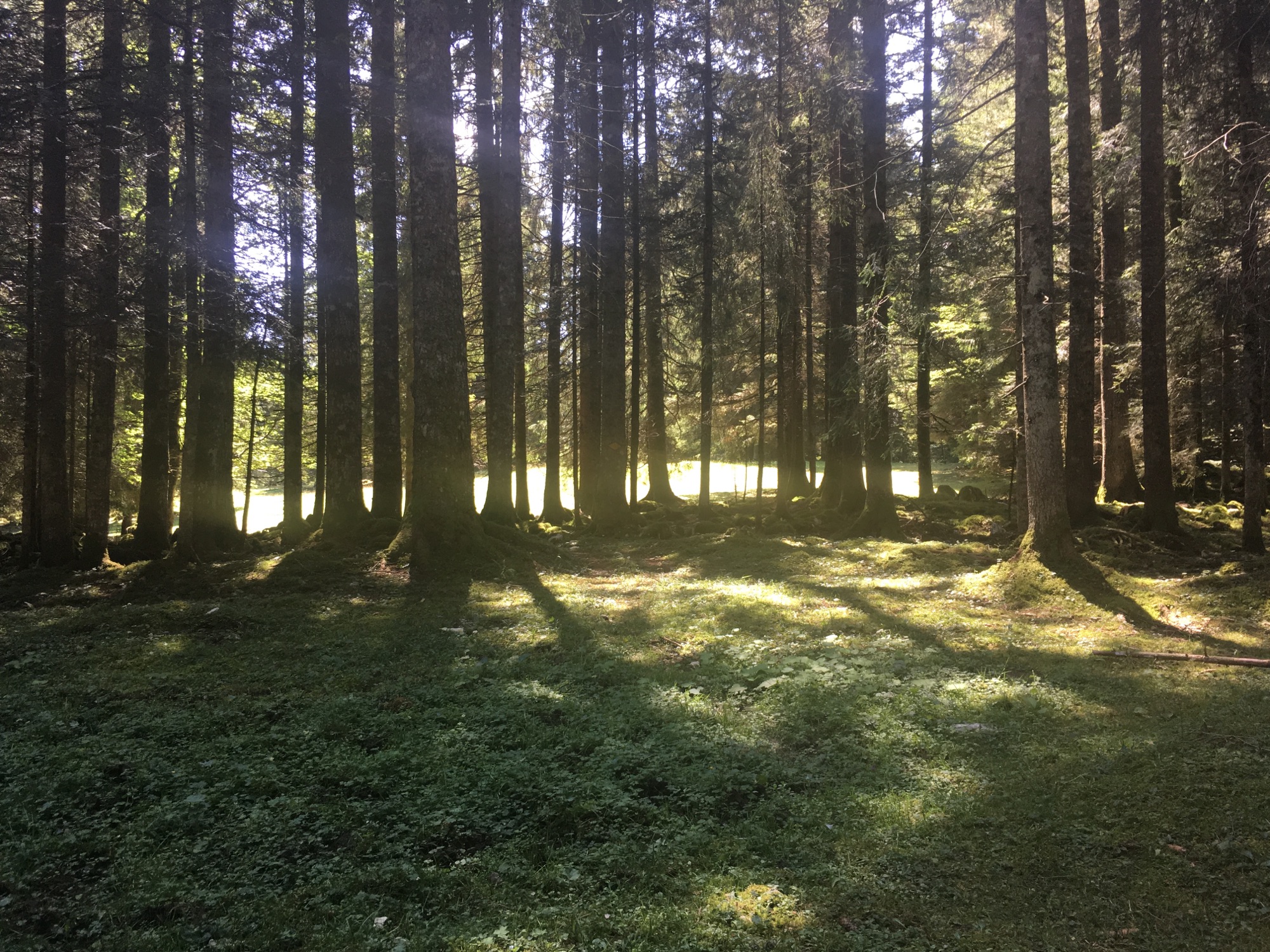
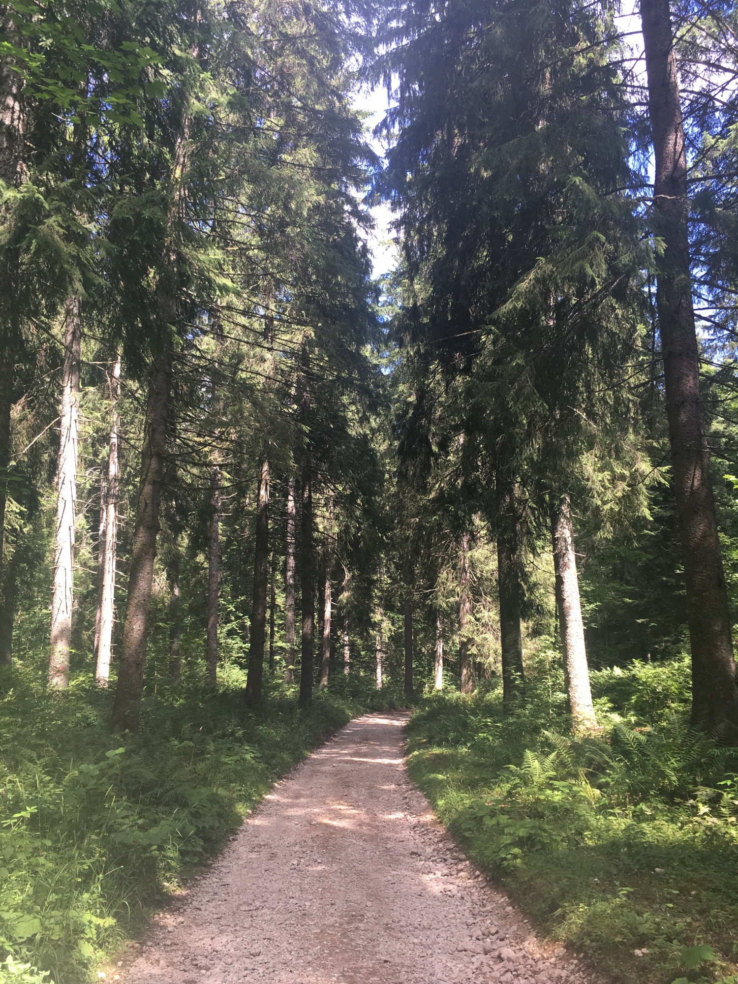
The route that I chose was luckily no one elses choice and I got to be on my own. After walking about 20 meters along the car mainroad, I branched off, entering a magical patch of forest and was greeted by a small group of does gracing on a forest clearing, seemingly not at all afraid of me. It was one of those moments, where I was reminded, that I am just a visitor in other living beings habitat and it is up to me to adapt; so I walked carefully and slowly past them.
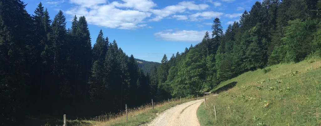
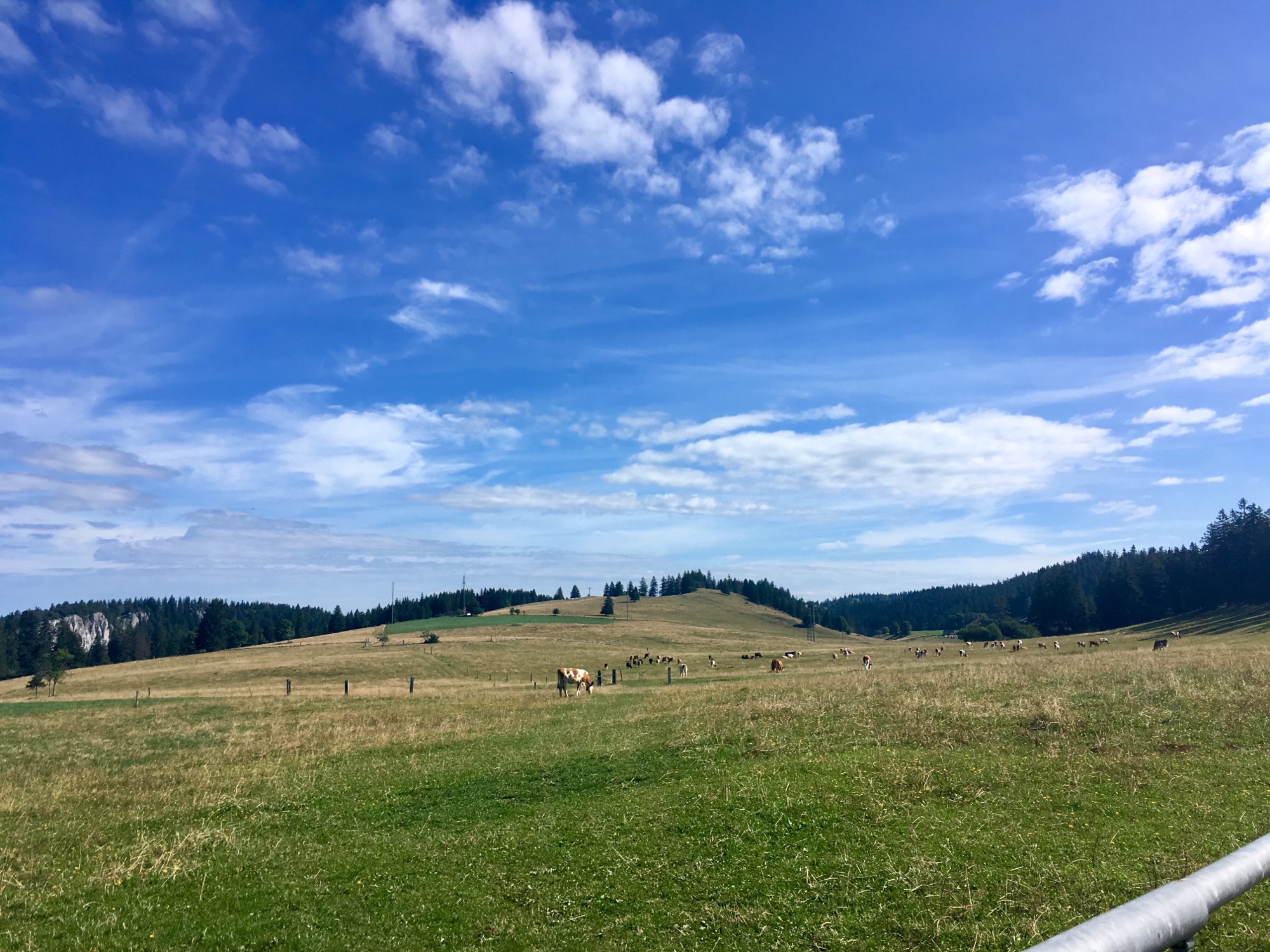
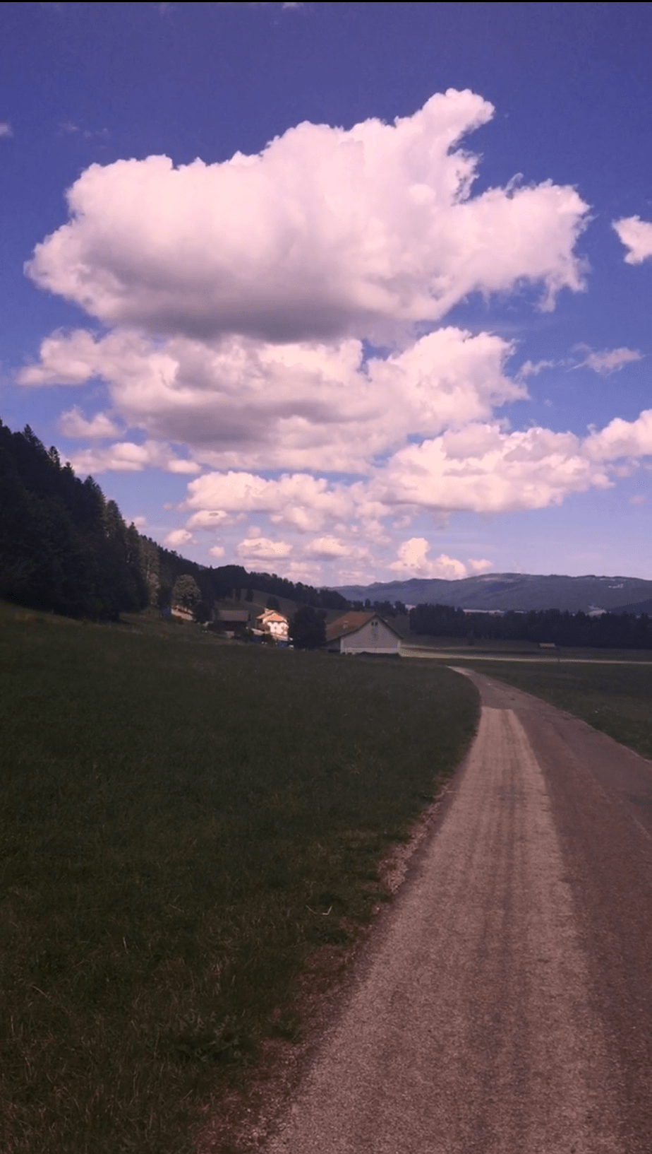
Coming out of the forest, the path lead over green pastures; apart from the occasional farmhouse, it was a very secluded route. No villages, no cars, bus stops and serene silence.
I enjoyed the peace and being completely alone and the freedom of not having set a destination to reach at the end of the day. After traversing the Combe de la Racine Dessus, I passed by some more small farmhouses and residences at Cervelet Dessous and La Paroisse, still without seeing a single person.
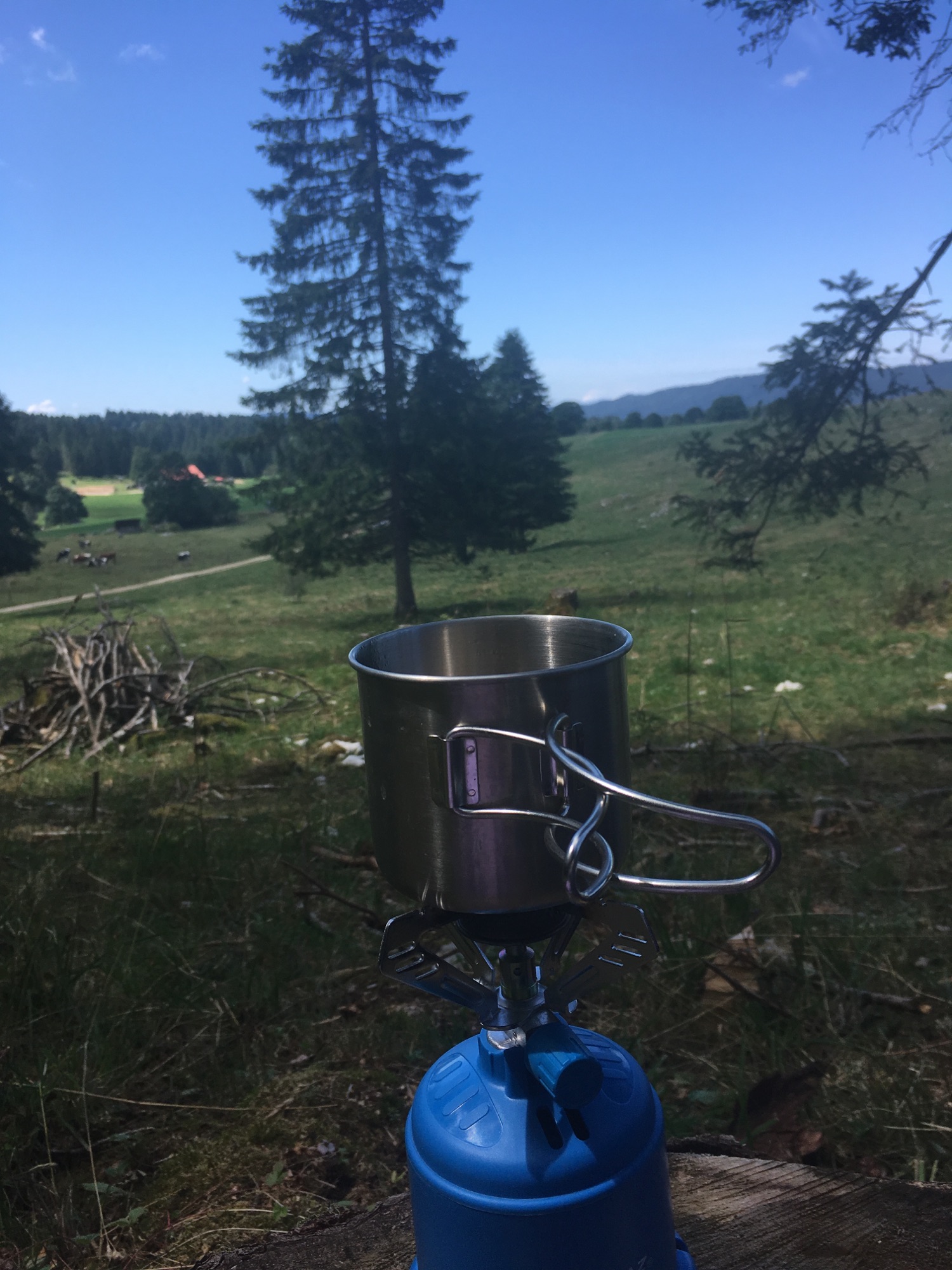
I crossed the meadow of Derriere les haies via a gravel road and about 1 hour into my hike, I chose to have my lunch at the edge of the forest overlooking the meadow. While I was waiting for my quinoa to be ready I listened to the cowbells in the distance, enjoying the cool breeze under the shade of the big majestic needletrees.

Continuing on from my lunchspot, the path lead through the forest and then the Combe Pellaton, continuously following a 4×4 road for about 30 minutes. Upon exiting the forest, I was offered a beautiful view of the Vallée des Ponts and a mountain chain, whose name I couldn’t find out until today. Passing the farm Combe Pellaton, carefully decorated with colorful flowerpots and little statues, I was greeted by a whole committee of curious cats, stroking my feet and sniffing my shoes. It was as if they knew that I was in desperate need of another little break and some cat petting and companionship, missing my own fourlegged companion Yuki at home 🙂
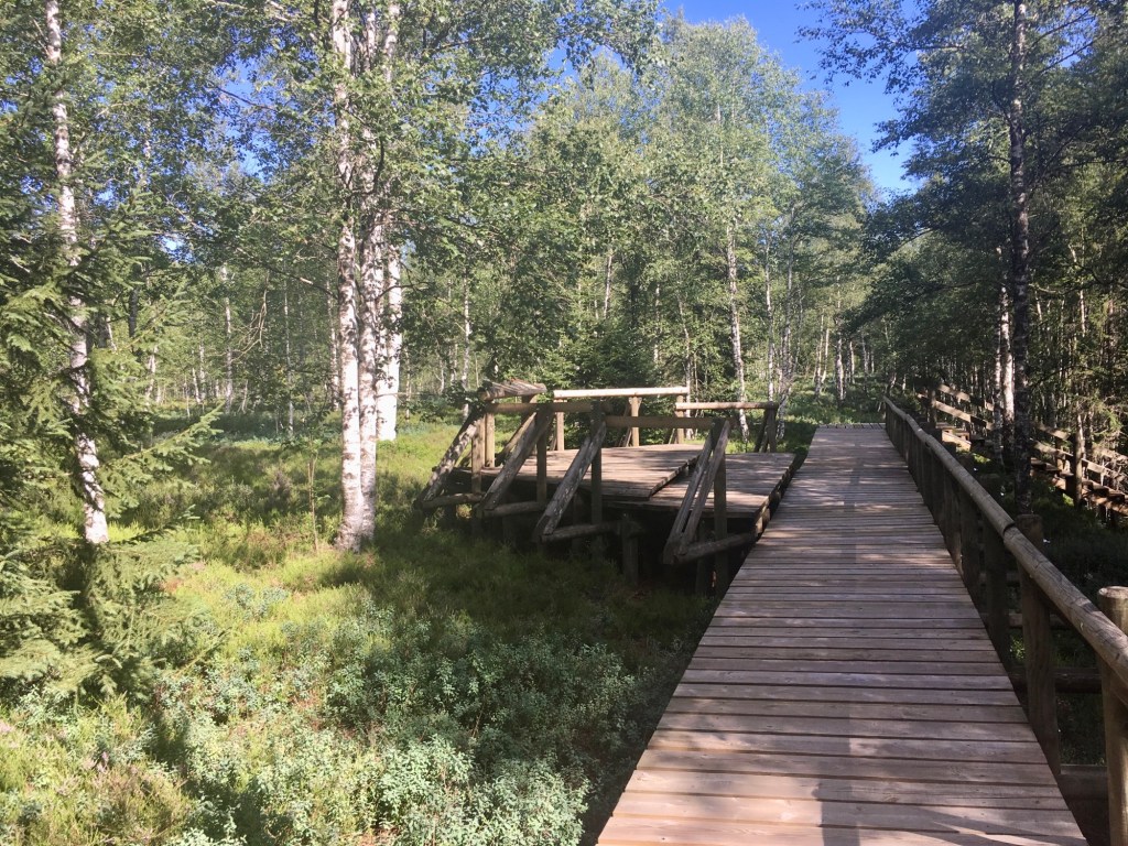
From here on out the route followed the same small asphalt road until Les Ponts de Martel. Having read about the moorland landscape that is also responsible for giving the village its name, I wanted to take the time to explore it for myself. “Les Ponts” is referring to the wooden paths and footbridges that had to be created to cross the moorland areas; “Martel” is a dialect word for marais which means moor in french.


Through a map reading error, which I attribute to my tiredness, I first followed the wrong path. It lead me however through a beautiful tree alley to the “Source sulfureuse”, a Sulfur spring and Source of drinking water, which is said to have a therapeutic effect. The source is very inconspicuous, almost a bit hidden away from the small road, but the detour there alone into the Vallée des Ponts is worth it. Turning around, I headed back on the the gravel road, where I after about 30 meters turned left and made my way towards the Marais Rouges, the moor nature trail. A beautiful and fascinating territory, rich with history it felt to me a bit like entering a church.
After visiting the moor and arriving at the trainstation of Les Ponts de Martel, I decided to treat myself to something to drink at the little Café and consult my options for hotels in the area. By chance I came across the hotel “Von Bergen” in La Sagne, a couple of villages away and decided to try my luck on a room.
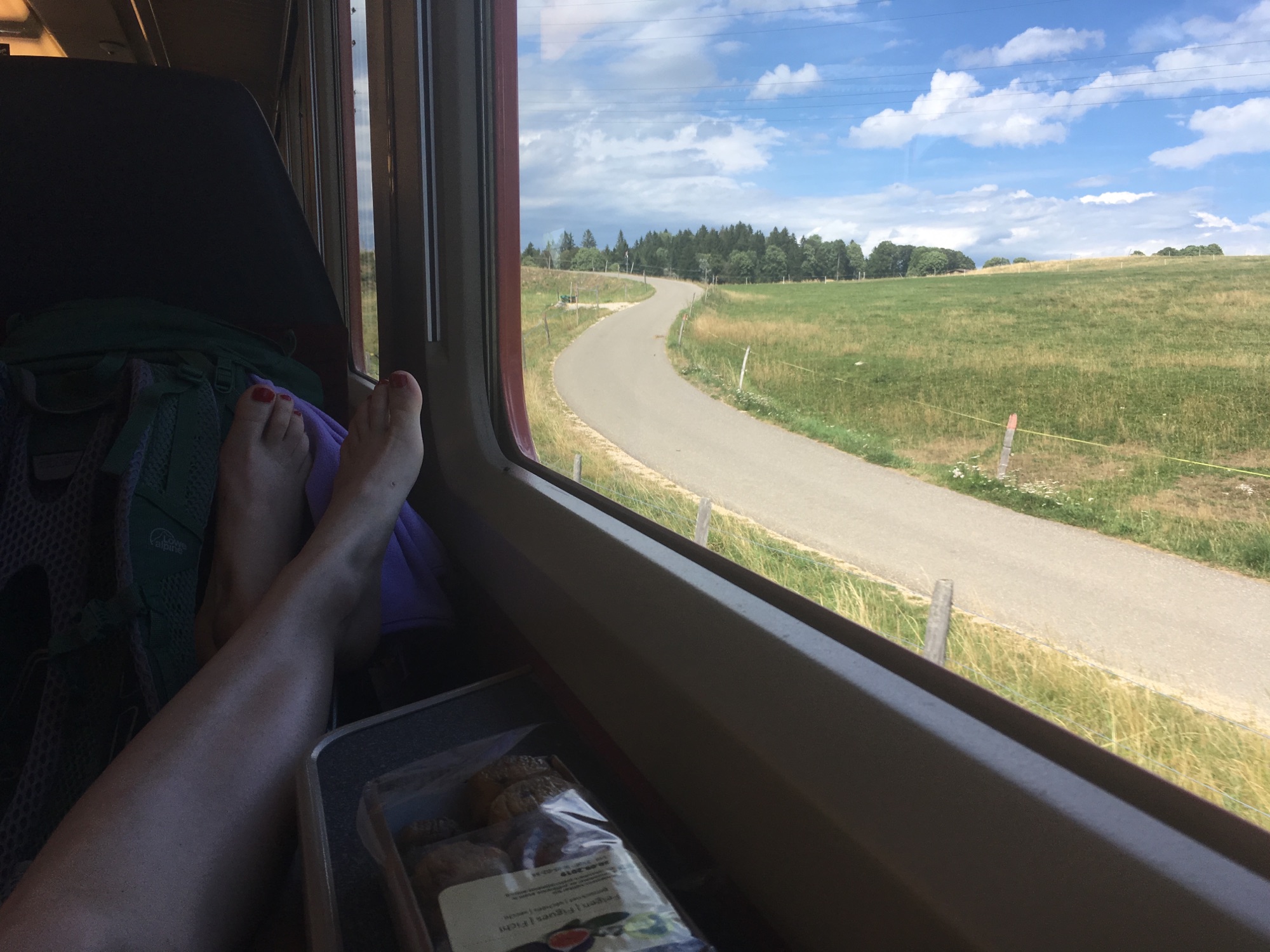
To get to La Sagne, one takes the smallest train that I have ever been in, which drives pretty much in a straight line from village to village and ultimately ends up in La Chaux-des-Fonds.
I knew the approximately 2.5 km long street-lined village of La Sagne up until then only from passing though by car and never thought much of it – except that the name always amused me. The little village center was welcoming in the calm evening atmosphere and the hotel was situated right there next to the village fountain.
Luckily they had still a room available and told me they could even serve me a 2 course dinner in an hour. The old house had so much charm – as did the Hotel operators and my little room was decorated in a loving fashion with a lot of vintage furniture; I felt very much at home. Entering back into a more “operated” civilization after a days walk can already feel a bit like a culture shock and a cozy, homy residence for the night holds always a lot of value to me.
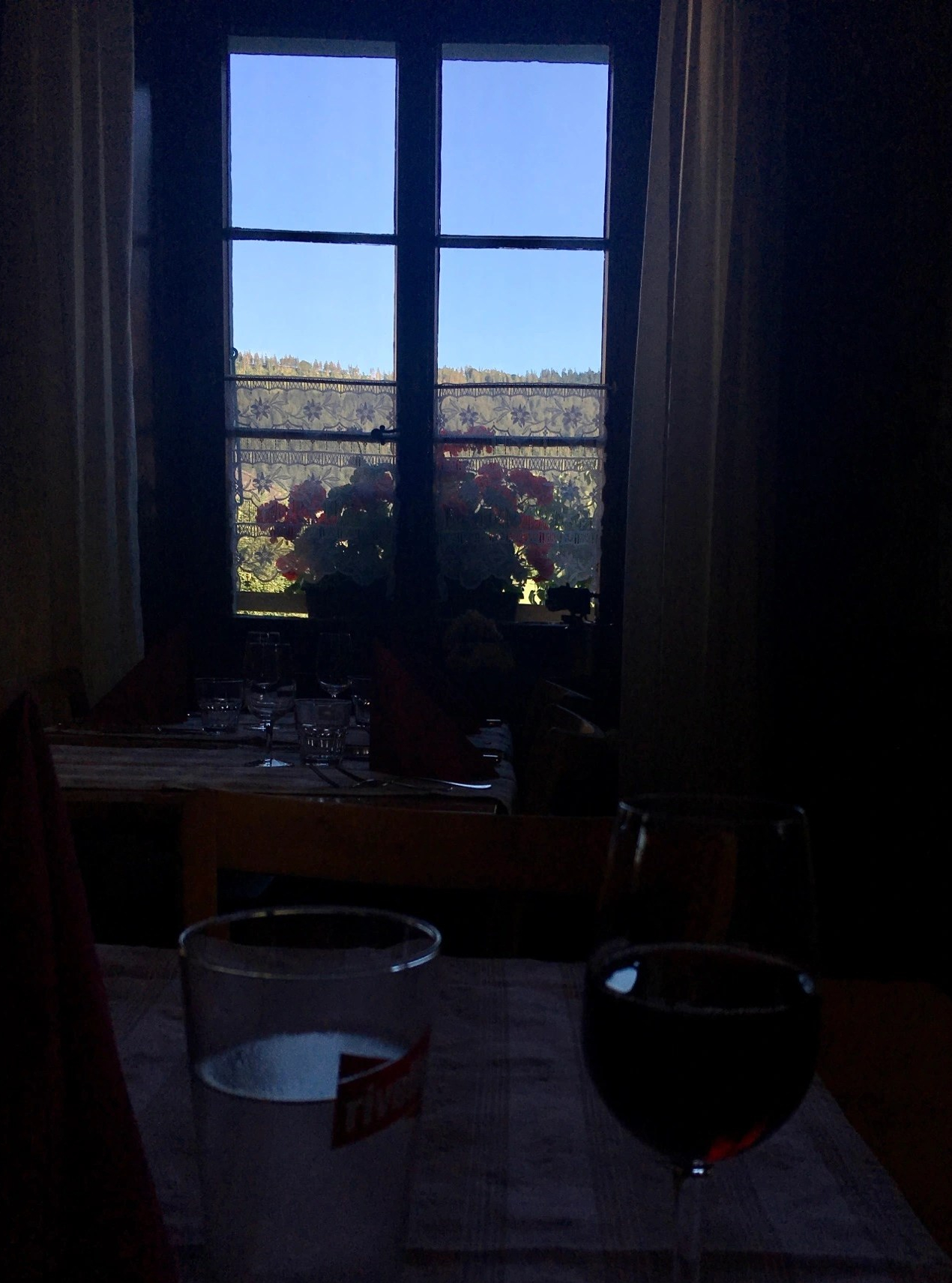
I enjoyed my cheesy “Spätzli-Veggie Dish” with a glass of Pinot Noir, a beautiful view, cheerful chatter in the backround and good literature. To this day I think about that dinner. It was absolutely delicious and a perfect end to a magical day in solitude!


Click here to see this section on SchweizMobil
Day 2: La Sagne via Vue des Alpes to La Cibourg
I started the day with a clear blue sky; perfect conditions for the hike up to La Vue des Alpes. That section was marked as a 2 hour 25 hike and I intended to see from there, if and how I would continue. First I traversed the Valleé des Ponts, which still impressed me a lot with its vastness.
I ascended though the Combe des Quignets, an erosion valley on the western slope of the Tête de Ran. Still lying in the shadows, the little valley held a certain magic and peace but also seemed to urge me to pass through and get further and further up. I felt the steady ascent, which promised what I hoped to be a spectacular view at the end of it. Upon exiting the valley, I was greeted by warm sunshine; the little “Relais du Mont Dar” looked like a nice place for a cup of coffee but was sadly not yet open, so I marched on.

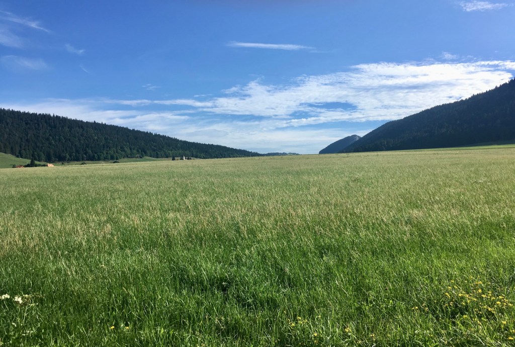
The breathtaking view I had hoped for was not long in coming; walking over wide open pastures with a strong and pushy wind in my back, I reached the meadow of L’Ety where I awarded myself a little break to enjoy the vastness of both the sky and fields below. Sometimes I find it hard to say, what makes a place so special, what exactly it is that gives me goosebumps and puts a smile on my face. Sometimes it just does and it stays in my memory for a long time. That was – and still it to this day- the case with this view.

A slight bend to the left lead me around the mountain Tête de Ran and I reached the Restaurant “La Clef des Champs” at the foot of the mountain, which was sadly also still closed. The view into the distance and a first glimpse of the alps was however beautiful.
From here it would only be a short 15 minute – but steep 90 meters- ascent to the top of the mountain. I decided against it and continued my hike direction Vue des Alpes. Starting from here, I followed the section No.9 of the “Jura Crest Trail” until Vue des Alpes. Passing through Derrière Tête de Ran, a little vacation village and a couple of grazing cows, I entered the forest and followed the narrow path on the ridge. Checking the map ahead of my hike today, I was a bit afraid, that this will be challenging for me, but it is so much protected by the trees, that it didn’t feel like a ridge-walk to me but rather a stroll through the forest with a breeze 😉
Coming out of the forest, I ended up directly at the toboggan run with a lot of cheering people sliding down the hill. And I got to understand firsthand, why this place is called Vue des Alpes. Their snowy peaks sticking out from a sea of clouds, there they were – impressive and humbling as always.

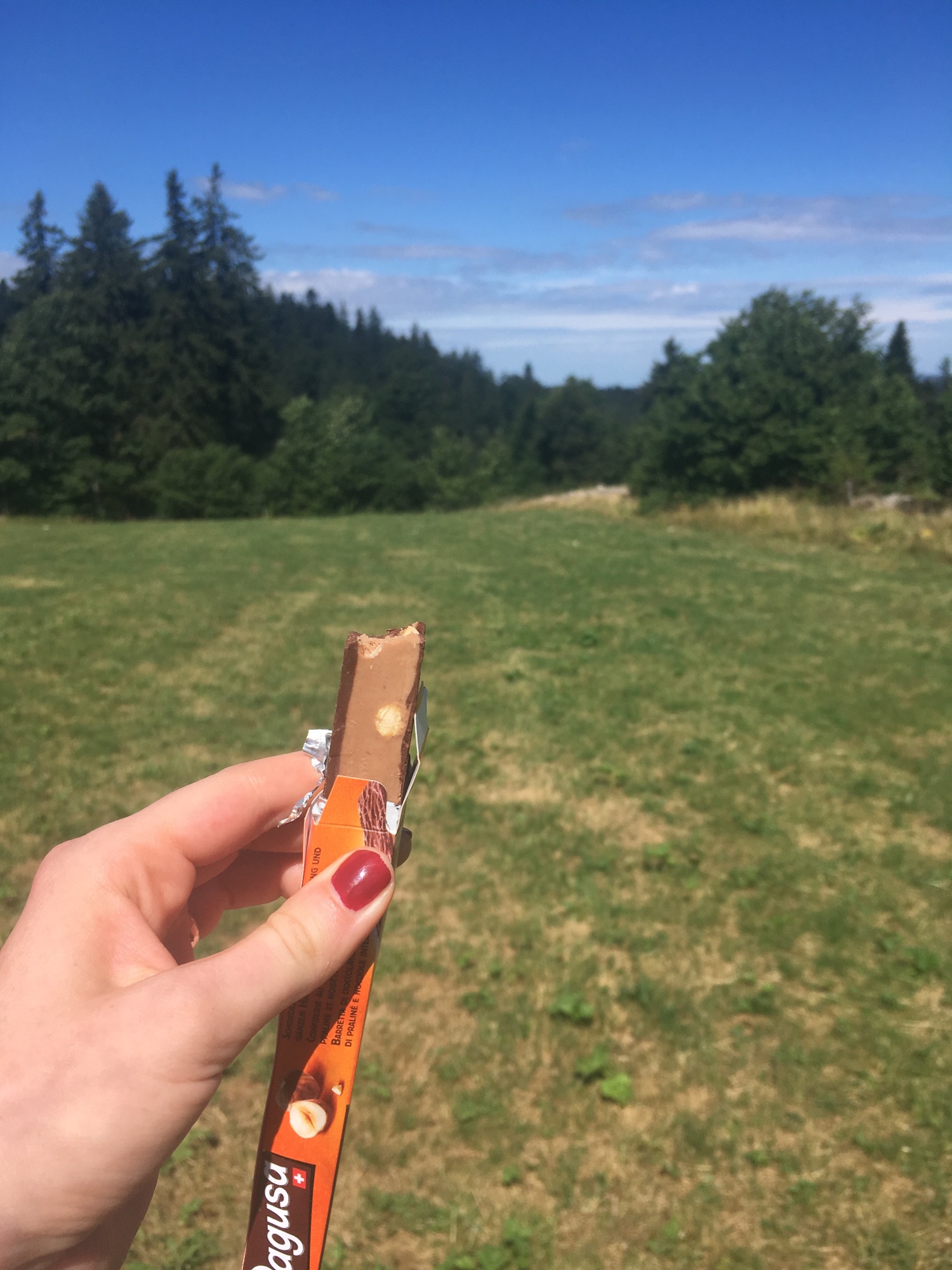
After stacking up on some snacks for the remainder of the hike, I said goodbye to the alps and made my way down, following the trail direction La Cibourg. The path followed the busy car road for a few meters, before branching off into the fields and then into the forest of Les Combes, putting behind me about 180 meters in altitude.
The little trail ultimately ended on a smaller asphalt road, which it followed all the way down to the highway junction at Roc Mildeu. Probably the least nice and slightly unnerving part of todays section, the path leads underneath the highway before branching off into the woods again. While it was a bit uncomfortable to cross the highway, the area still held a certain fascination to me; this almost artful highway-installation of chaotically winding asphalt roads surrounded by rocks and forest. Nonetheless I was glad to leave those clear human-made structures behind me.
Walking under the shade of the trees felt nice in the warm August sun and despite not being the most scenic route of this two day hike, I enjoyed the serenity, the silence and the effortless walking on the soft forest floor, as well as the occasional glimpse of the green wide valley next to me.
At Jolimont I exited the forest and decided to take my lunch and rest under a young tree in the dry trimmed grass close to the railroads. Apart from the grasshoppers chirping and the wind rustling through the trees, there was no sound (not one train passed on those railroads while I was there) and I was almost tempted to take a little nap. The smell of grass and the warm air promised a summer full of adventures and possibilities. It still amazes me, how while hiking I always explore a whole different level of content in simplicity. Everything is good enough exactly as it is provided by nature and there is nothing that would make it more perfect; no vaster views, greener grass, more colorful flowers… And therefore the deep content felt is in itself absolutely complete and perfect.


From Jolimont it was another roughly 45 minutes to La Cibourg. The path led over wide fields of grass and after a short section spent in the canton of Bernese Jura, I crossed the canton border back to the Neuchâtel Jura.
The last meters to the trainstation of La Cibourg followed section 4 of the “Chemin du Jura Bernois” and it was an easy final march with some last beautiful wide open views to enjoy.
Arriving at the little trainstation, I suddenly felt how exhausted I was; a content exhausted but exhausted nonetheless. Grateful to have brought my Flip Flops with me, I finally took off my hiking boots and socks and aired my tired feet. It would be another 40 minutes until the train would arrive, nothing to do really in La Cibourg – except sit and wait. I didn’t mind.


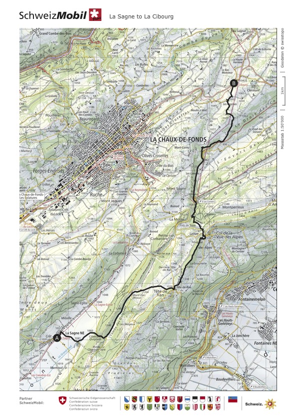
Click here to see this section on SchweizMobil
It is fascinating where one can end up in 2 short days or even a couple of hours; literally in for example how a landscape can change and metaphorically in how feelings, even opinions within oneself shift.
While there were a couple of truly amazing vistas during those two days, I ultimately think that this is not why I did this hike (not that that was a conscious decision beforehand). Henry David Thoreau is quoted in his 1862 essay “Walking” as saying
We should go forth on the shortest walk, perchance, in the spirit of undying adventure, never to return (…)
I think in a sense – though not a seriously as Thoreau probably meant it- this is what I did these two days. Even if for me it was absolutely clear that I will return home, the commitment to immerse myself fully in the adventure of being on the trail, the forests, fields, valleys and the present moment – just as it is. So as to learn to be content with every adventurous step I take.


Route overview
- Duration: 2 Days
- Total distance: 31.7 km
- Total ascent/descent: 839m/868m
- Highest point: 1’370m
Day-by-day breakdown
| Day 1: La Brévine to Les Ponts-de-Martel | Difficulty: T1 (Hiking Trail) Length: 16.31 km Duration: 4:04 h Ascent/Descent: 278m/316m |
| Day 2: Les Ponts-de-Martel to La Cibourg | Difficulty: T1 (Hiking Trail) Length: 15.37 km Duration: 4:18 h Ascent/Descent: 561m/552m |
Some more useful facts about this hike
| Best season: This hike works well for Summer and Autumn. |
| Trail exposure: Minimal. There is a slightly exposed section between Tête de Ran and Vue des Alpes. |
- If you were to continue walking from Les Ponts de Martel to La Sagne, that would add another 2 hours 45 and 9.40 km to your hike.
- The restaurant of the Hotel Von Bergen is not always open and it is therefore worth it to check ahead of time.
- There is a nice bakery in La Sagne to get some snacks for the road as well as a charming little food boutique with nice local products. Both are located right in the village center around the hotel Von Bergen.

Leave a comment