
From La Chaux-de-Fonds to Le Creux-des-Biches in 4 days
September 2017
There is a well known route called “Au fil du Doubs” that leads from Les Brenets to St. Ursanne (the section’s destinations include Maison Monsieur, Goumois, Soubey and St. Ursanne) and takes you into the at times very wild valley along the river Doubs. This is an easy and relaxed hike with very few ascends and barely any sort of exposed paths.
The hike I am sharing here is a variation of the original one. Instead of hiking from Les Brenets to St. Ursanne, I started in La Chaux-de-Fonds, and hiked only the second and third section of the original route and ended my journey in Le Creux-des-Biches.
For yet another variation of this hike, check out my post here.
Day 1: La Chaux-de-Fonds to Le Locle
I decided to start my hike in La Chaux-de-Fonds, the very unique “clock-city” in the canton of Nêuchatel and head to Le Locle.
Getting out of La Chaux-de-Fonds already proved difficult – that city is a mysterious maze to me. The way lead up through the city on the “Rue du Docteur Coullery” all the way to the edge of the forest. There is something special to that gateway from city into nature, as if you are leaving civilization behind (which is of course downright impossible here in Switzerland; but it certainly fueled my excitement to start my 4-day journey).

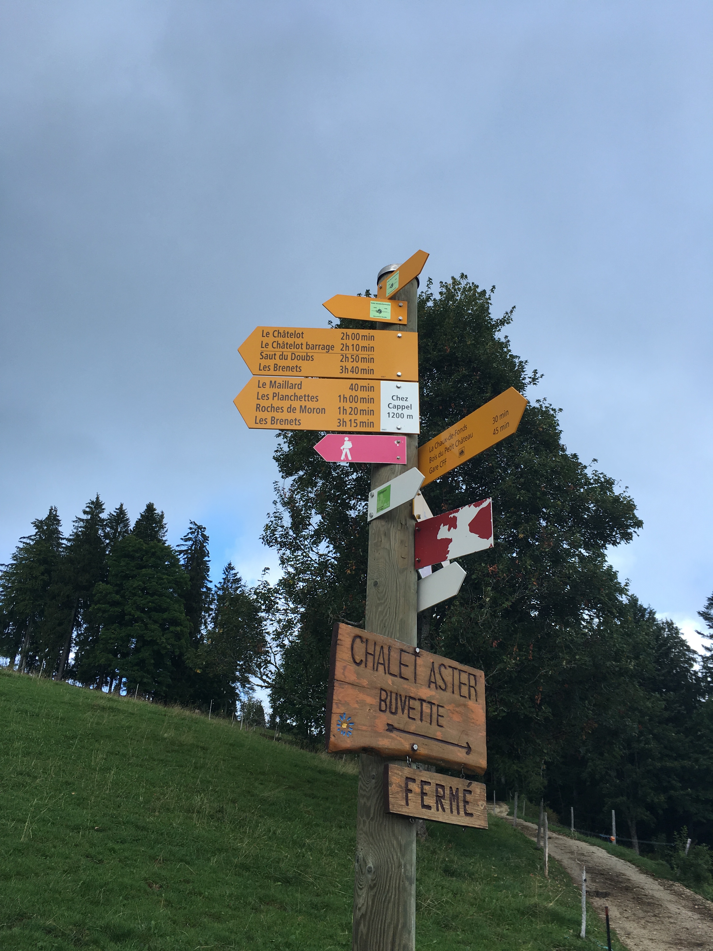
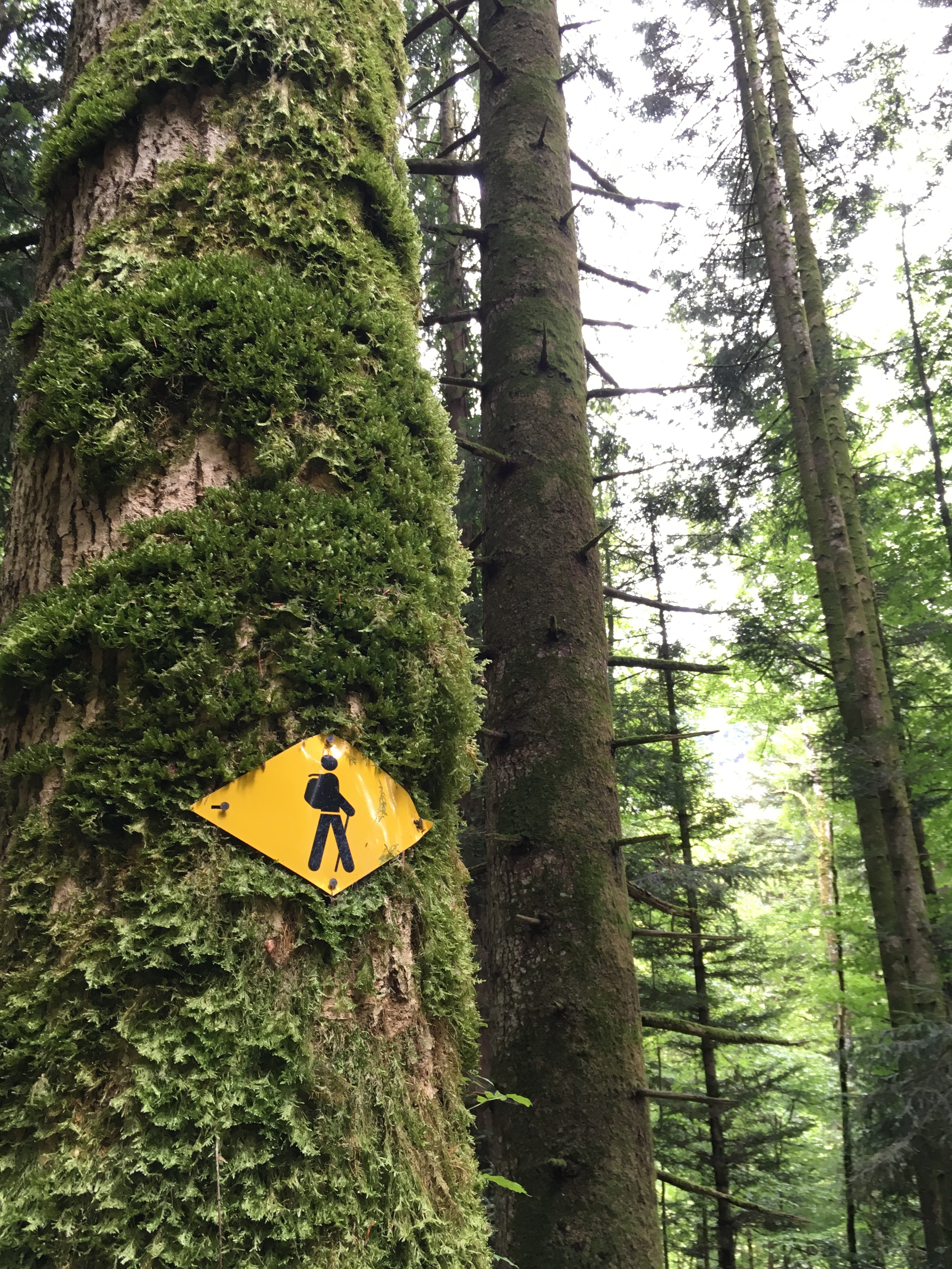
Through the forest I followed a wide well marked gravel road, that lead me to an a relatively steep asphalt street up to Chez Capel, following the hiking sign direction Le Maillard.
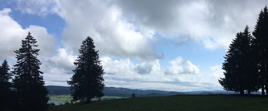
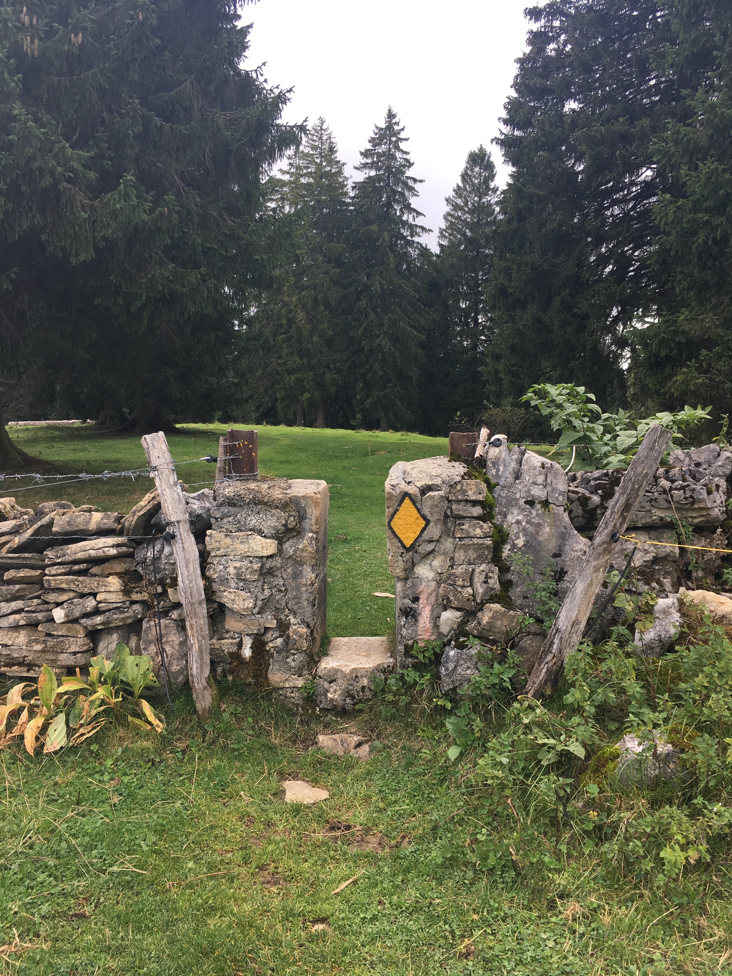
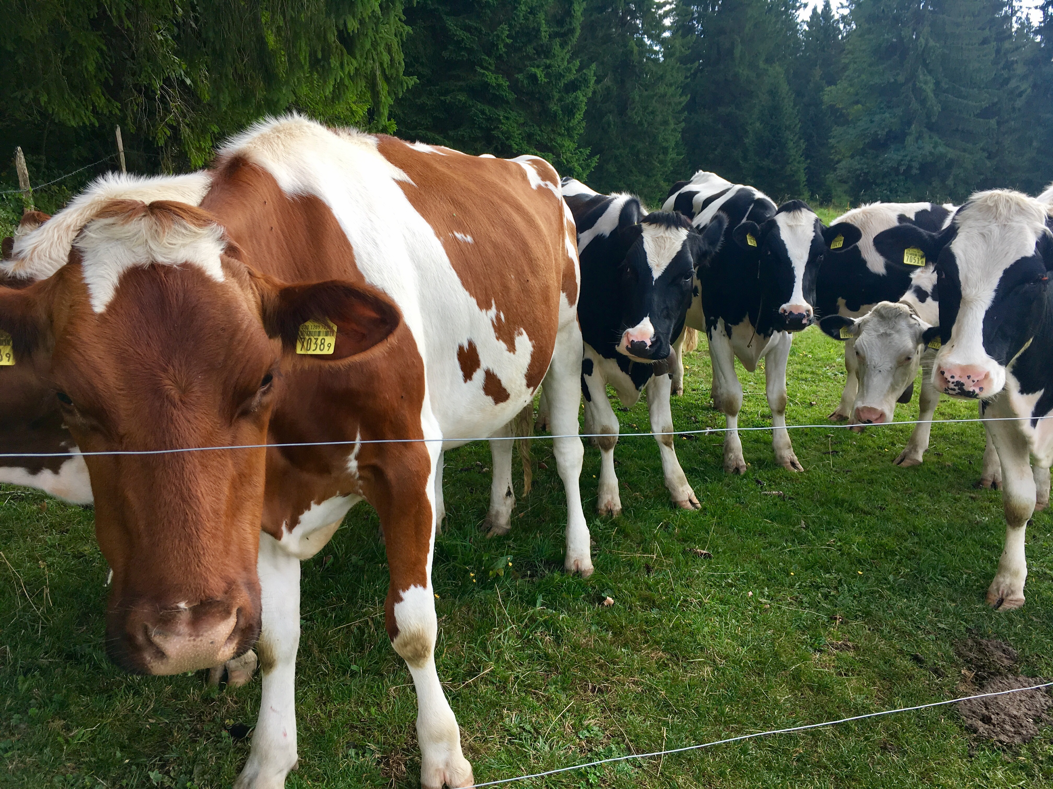
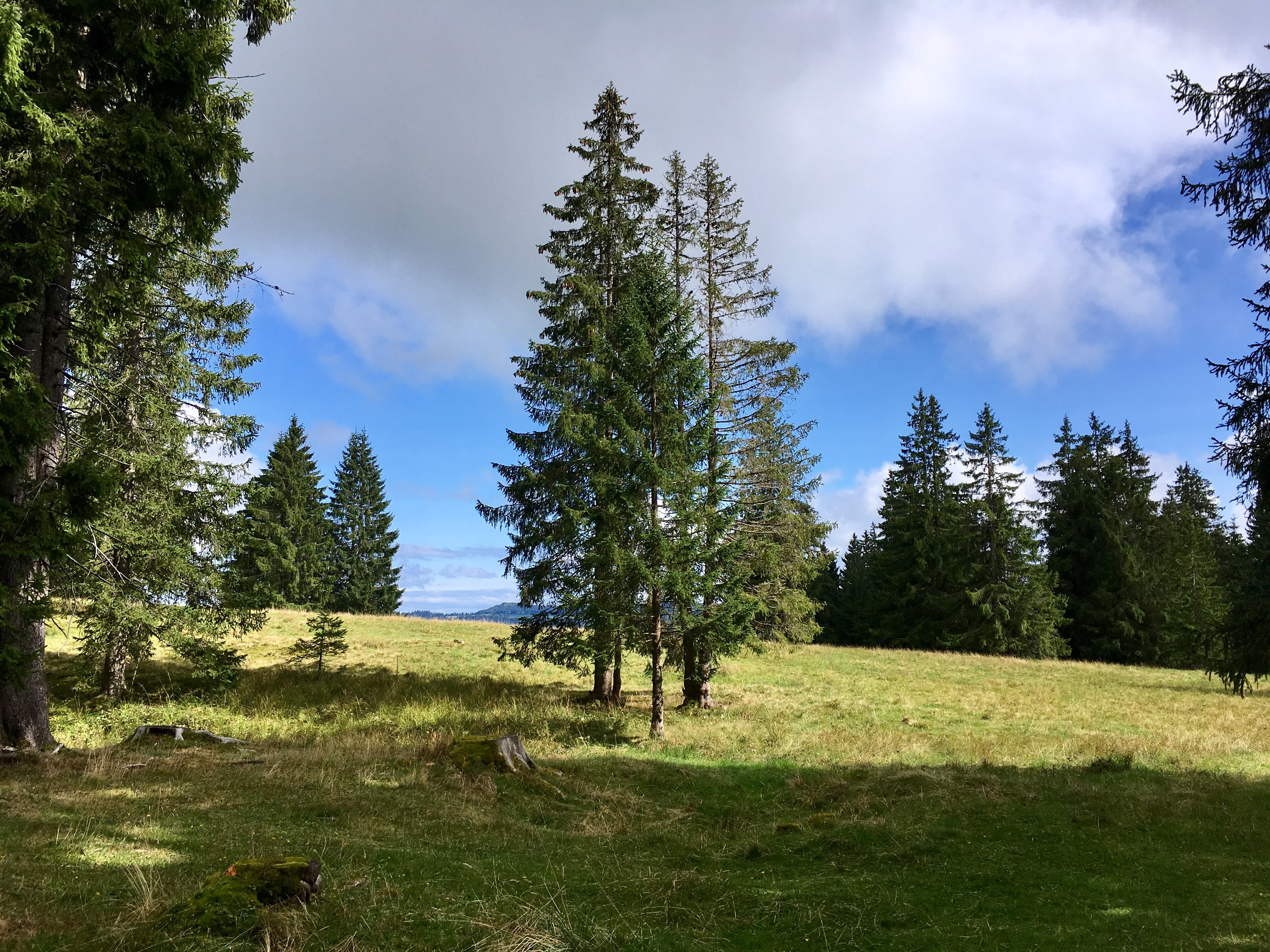
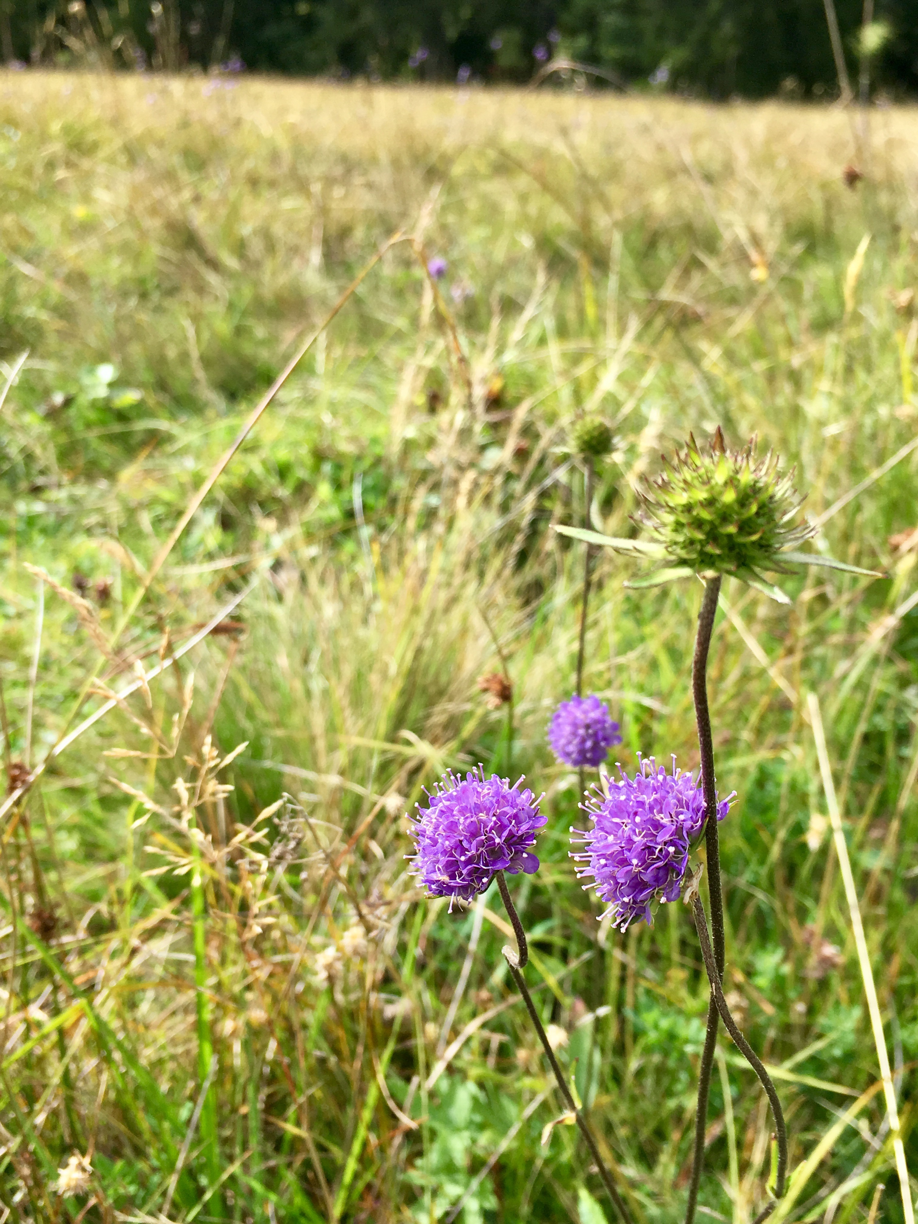
While the ascent was steep, it was rewarded with a beautiful view; I was guided over vast green fields littered with beautiful wild flowers and big fir trees that reminded me of mighty nature-guardians. From time to time the path lead through little sections of thick forest and occasionally over cow pastures with a curious and very observant audience of cows following my every step. Passing through several stonewalls via sometimes very unique doorways, the path lead by “La Galandrure” and headed on direction “La Ferme Modèle”.

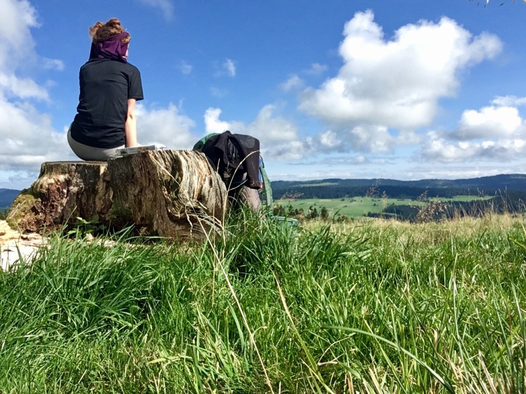
Right in time for an afternoon snack, I reached a lonely tree trunk in the middle of a field, overlooking a valley that seemed made for some cookies and coffee while admiring the vast view laying around me, enjoying a gentle breeze, hearing the cowbells in the distance and observing the wandering cloud formations in the sky. It is often in those moments when I stop walking for a moment, where I fully grasp the gift of being able to pack a backpack with the most essential belongings and choose my path and my pace as I go (even if of course, a little bit of planning ahead proves to be wise). I came to learn that stopping and resting on a hike is always a challenge for me; I am so eager to get ahead and see what’s still to come, that I often forget to stop for a break and something to eat. But when a spot is so inviting and beautiful, it is hard to just pass it by 🙂
After passing through one more farm (another thing that occurs frequently and took me some time to get used to) with a herd of very curious but very friendly cows, the remainder of the path mostly followed a small asphalt street until I could spot the first houses of Le Locle. The descent to the trainstation was a little steep but very short.
While not having decided beforehand, if I will still continue to hike from Le Locle to Les Brenets, where I would spend my first night, I ultimately decided against it and caught the bus directly to Les Brenets. (There would by the way be a direct route to Les Brenets without entering Le Locle, which would take you about the same time. I have never done it. If I will, I’ll let you know :-))
I had my tent with me and was intent on using it, so I chose a camping place near the Lac de Brenets, which was nearly empty, given the relatively cold weather. Camping season was definitely over and as far as campers in tents go, I was the only one. Everyone else was in a cozy warm campervan. I enjoyed my dinner in the restaurant of the Camping with a view over the lake, before turning in very early.

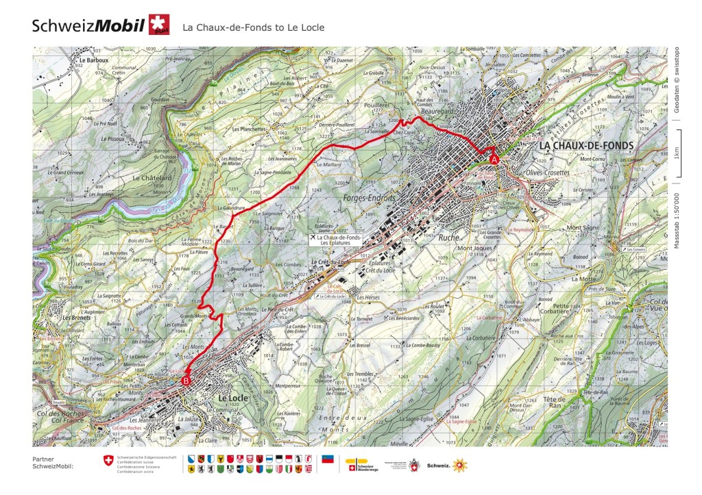
Click here to see this section on “SchweizMobil”
Day 2: Les Brenets/Biaufond to Goumois
Here you could now easily just continue hiking the “official” route (click here for that section), if you don’t want to interrupt your hikingflow with a bus ride, which would simply add another day to this hike.
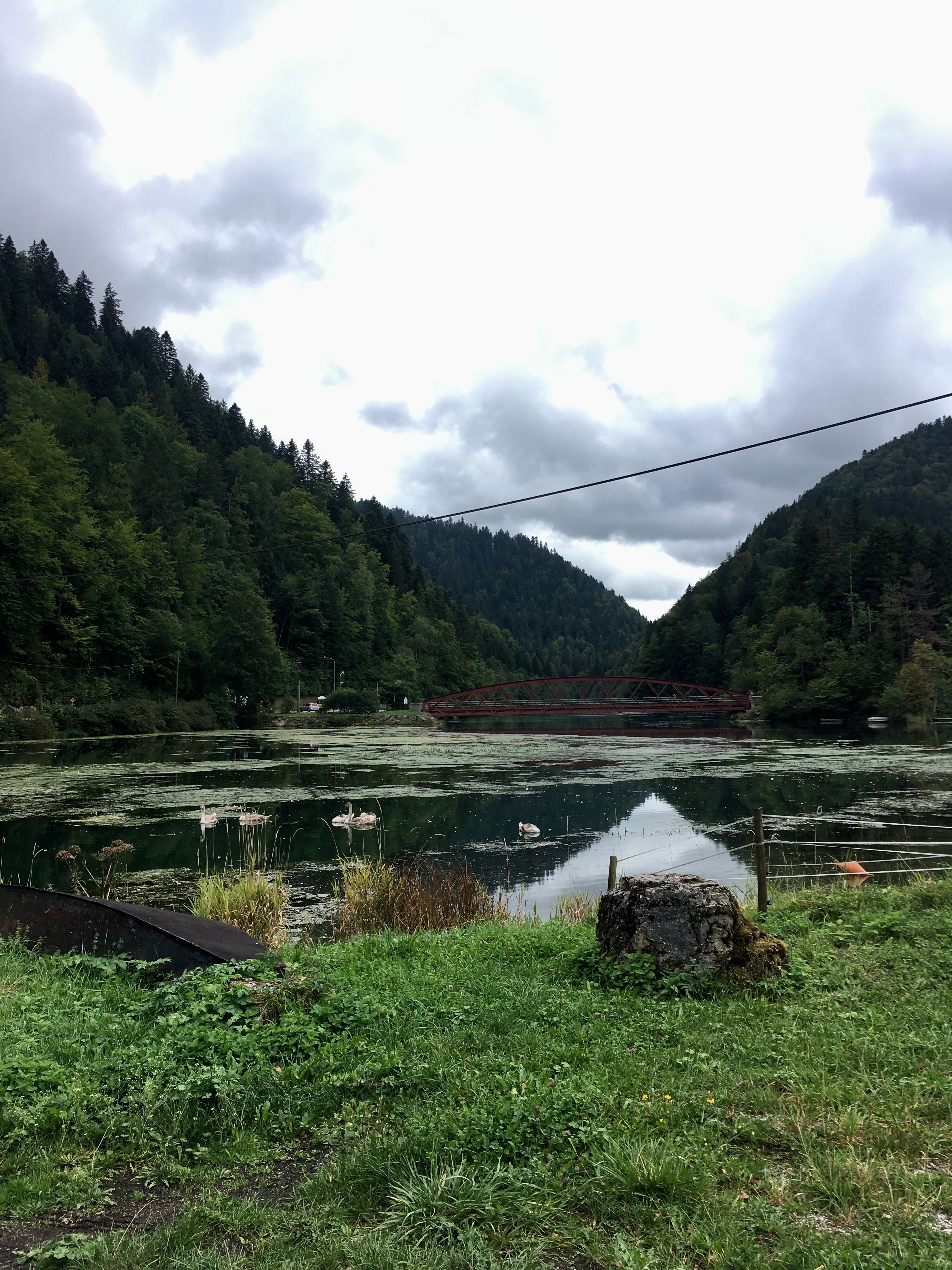
I chose to take the bus to Biaufond and therefore skip the first section of the “Fil du Doubs”. The night in the tent was very cold and I felt not very well rested; so the busride proved to be a welcome gentle wake up. Getting out of the bus, I was welcomed by a serene, and almost magical scenery. The lake Biaufond lay still, swans and ducks peacefully swimming in the water. Having not yet had a coffee or breakfast, I chose to head to the “Restaurant de Biaufond” at the border of the lake before starting my hike.
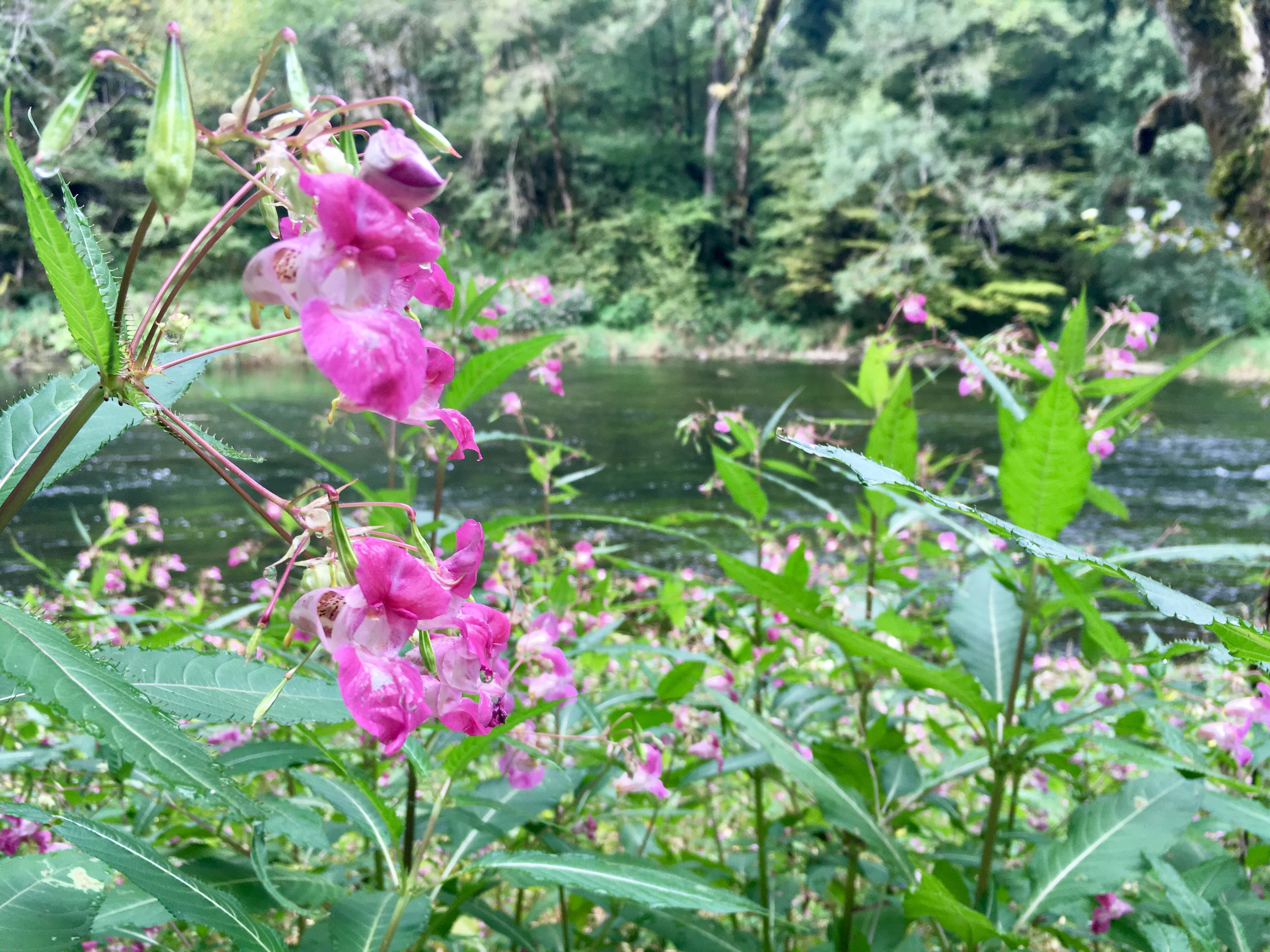
A coffee and a piece of apricot pie later and a full recharge of my phone and my powerbank, the trail led me upwards, offering a view of the lake from above. The grey cloudy sky and the slight wafts of fog fit well with the mysterious atmosphere surrounding this unique river valley. After a while the path led into a forest, where I spent the majority of this days section. One could choose to hike on the french side of the river all the way to La Goule, where the path apparently leads closer to the riverbank. Another time I will explore this version of the hike; but I can certainly also recommend this path.
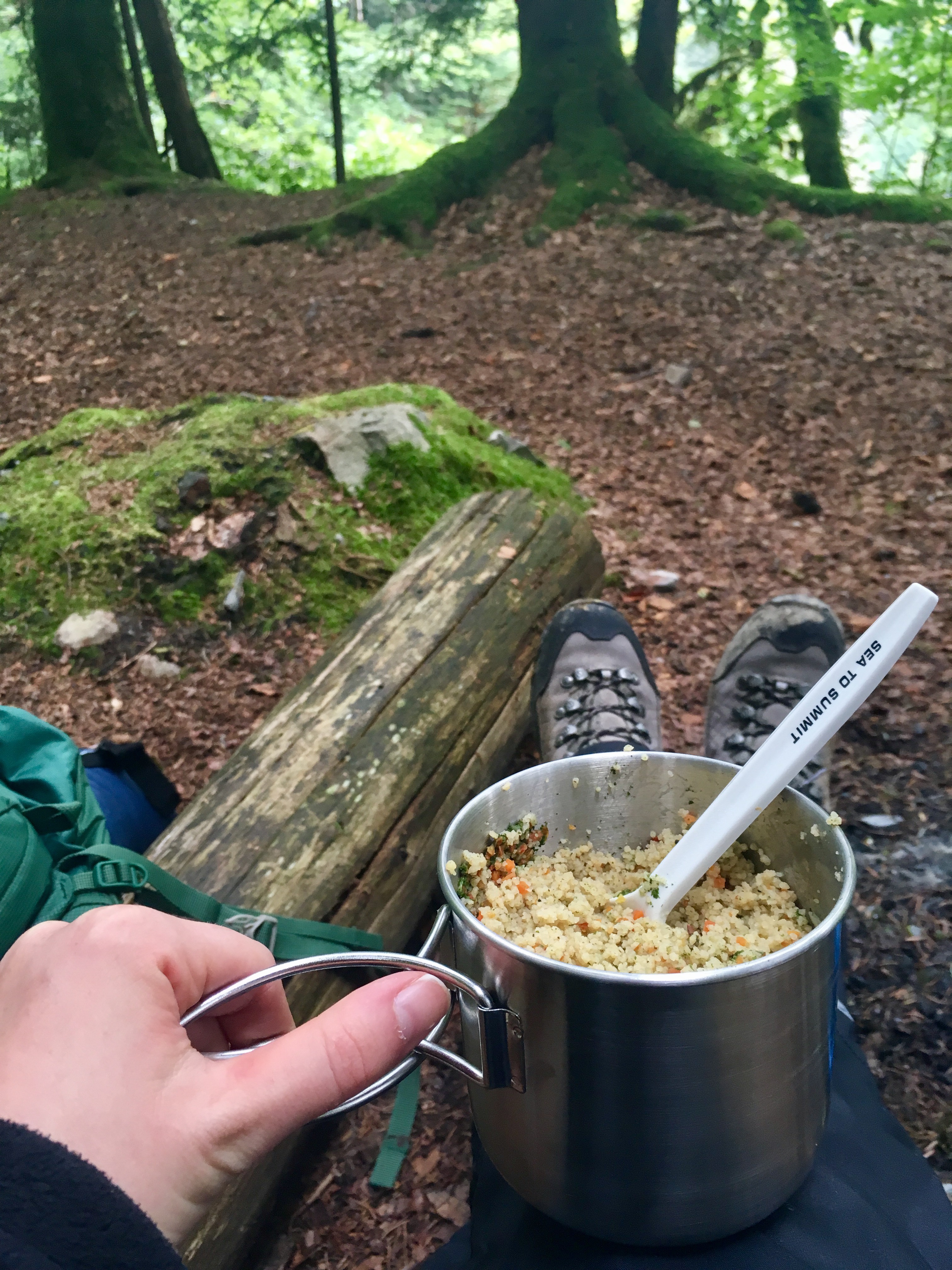
The river Doubs flowing calmly next or slightly below me -even though less often seen- was a peaceful companion on my walk. Sometimes I lost completely sight of him when the trail led higher up into the forest and then suddenly he reappeared right next to me. About halfway to La Goule I found myself a lunch-place, keeping with my promise to myself to take rest and enjoy the quiet of the forest.
One thing I came to do while hiking, kind of like a ritual, is to thank my “resting-places” before I leave. I always turn around one more time, after I strapped on my backpack and head back on the trail and appreciate the hospitality of the place. It is so fascinating to me, how for that small moment -sometimes I sit no longer than 15 or 20 minutes- those places feel like my home. To me it corresponds with the saying “home is where the heart is”.
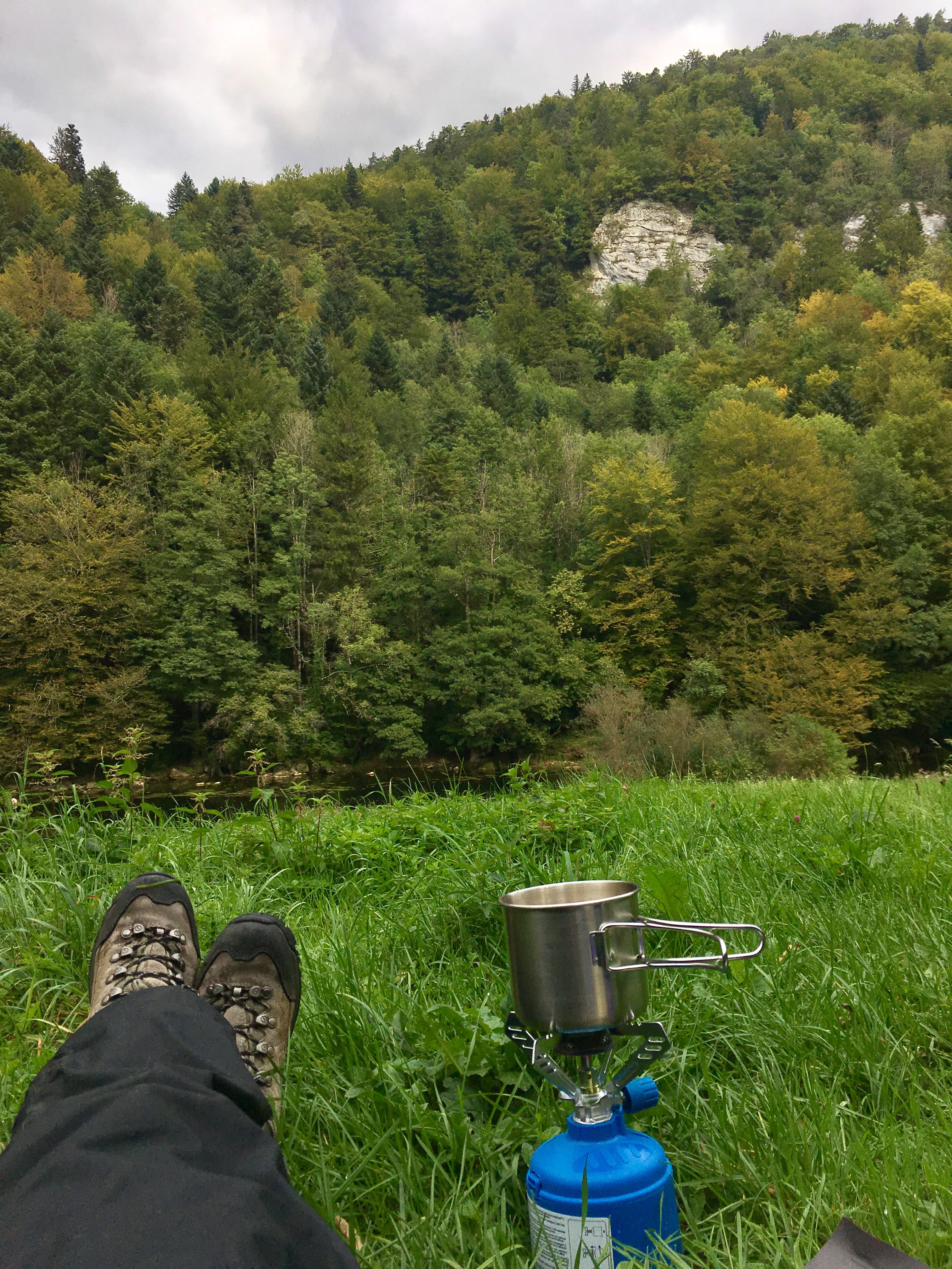
Despite the path being relatively flat for the most part, it turned out to be tiring. Reaching La Goule, I felt in need of something cold and sparkly to drink; with the afternoon sun breaking through the clouds and the sky slowly opening up, I took another rest in the Restaurant La Goule.

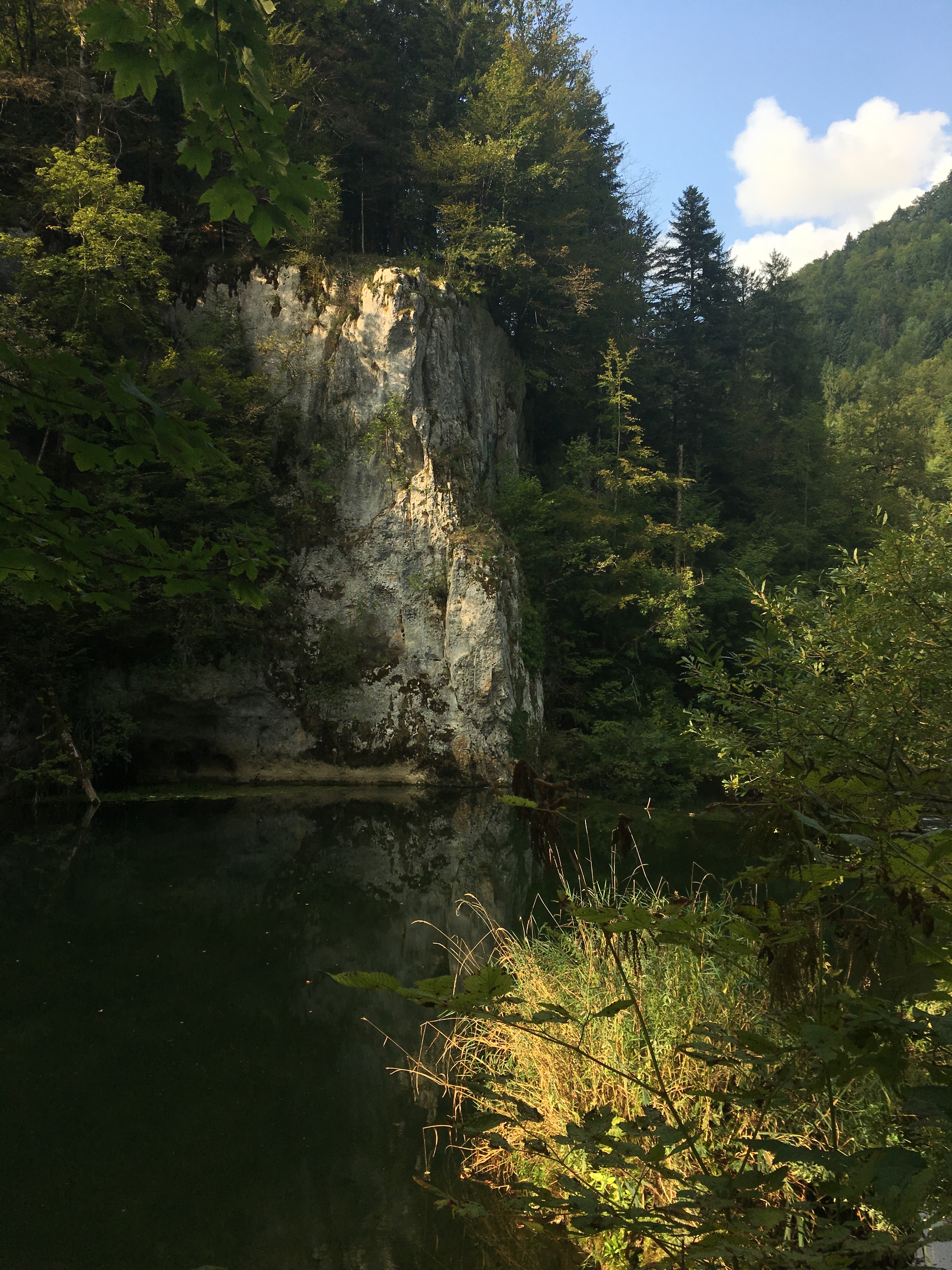

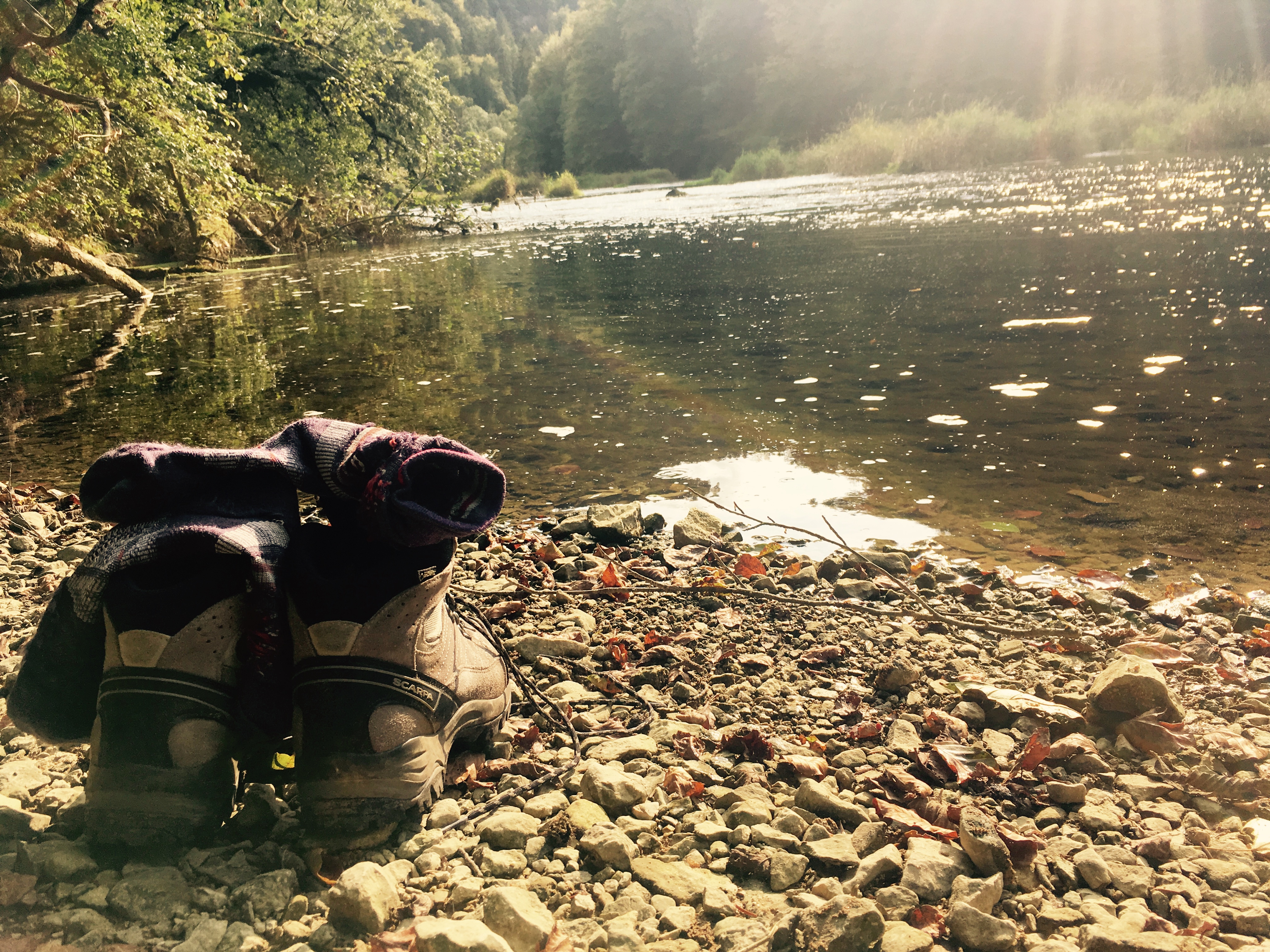
After La Goule the path continued to lead closely to the riverbank all the way to La Theusseret, which could be a place directly out of a fairytale. Rockformations drenched in golden evening sun, moss covered old trees and a charming little guesthouse with a restaurant, it is a beautiful place to slow down your walk and enjoy the magic that surrounds it. I let myself be tempted by the fresh water of the river and gave my feet a well deserved refreshing break.
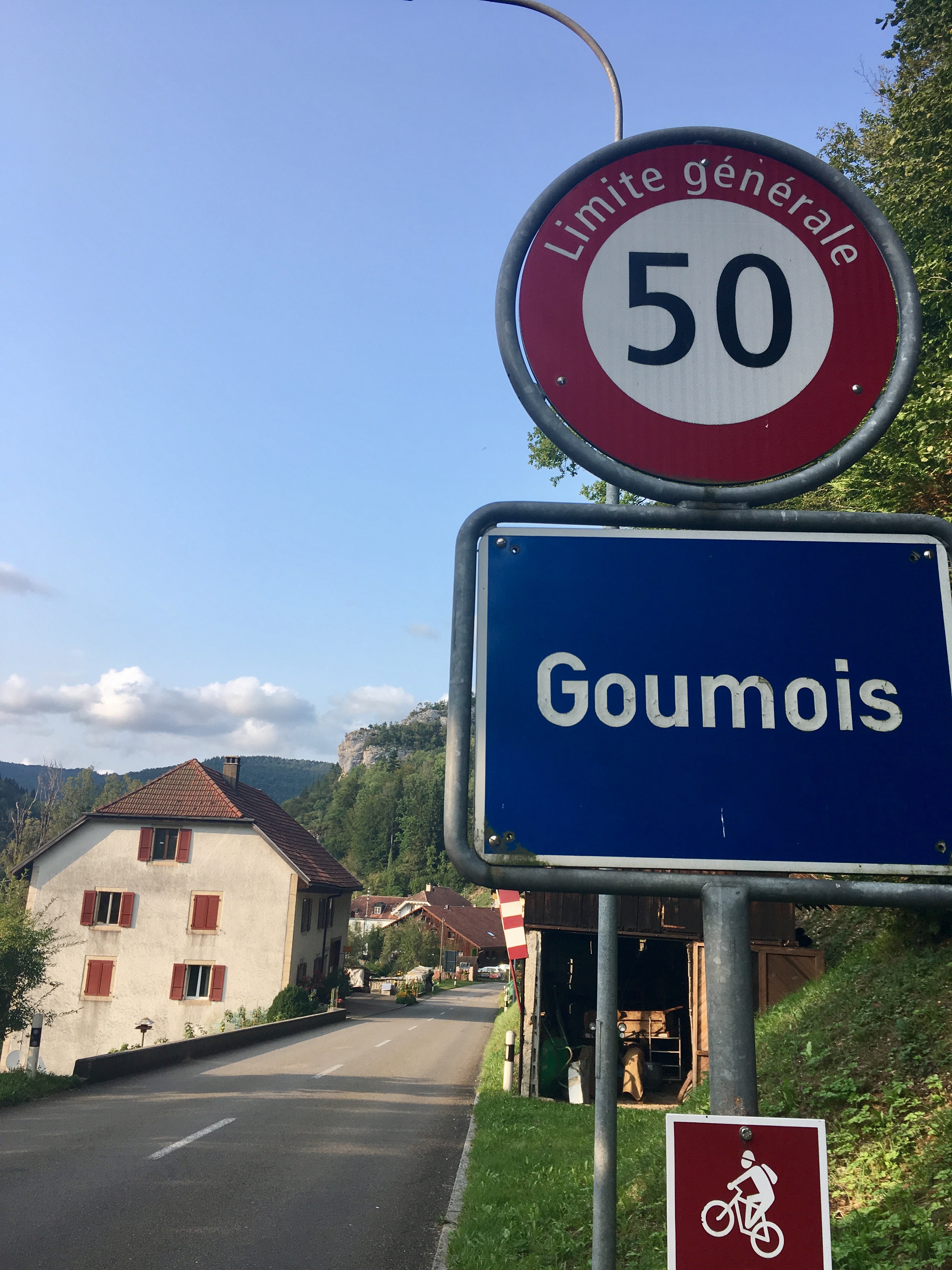
From La Theusseret it took me about another half hour, before I reached Goumois, todays destination. Having spent a very cold and uncozy night before in my tent, I was set to sleep in a hotel. But having no reservations made, I didn’t know what to expect in terms of availability. Goumois is very small and doesn’t have a big variety of hotels. Luckily I got the last remaining room in the Hôtel du Doubs on the swiss side of the river (a bridge in Goumois leads directly to France). Sitting next to a joyful and loud group of bikers, I enjoyed a dinner outside next to the Doubs, before sinking into a deep and -most importantly- warm sleep.


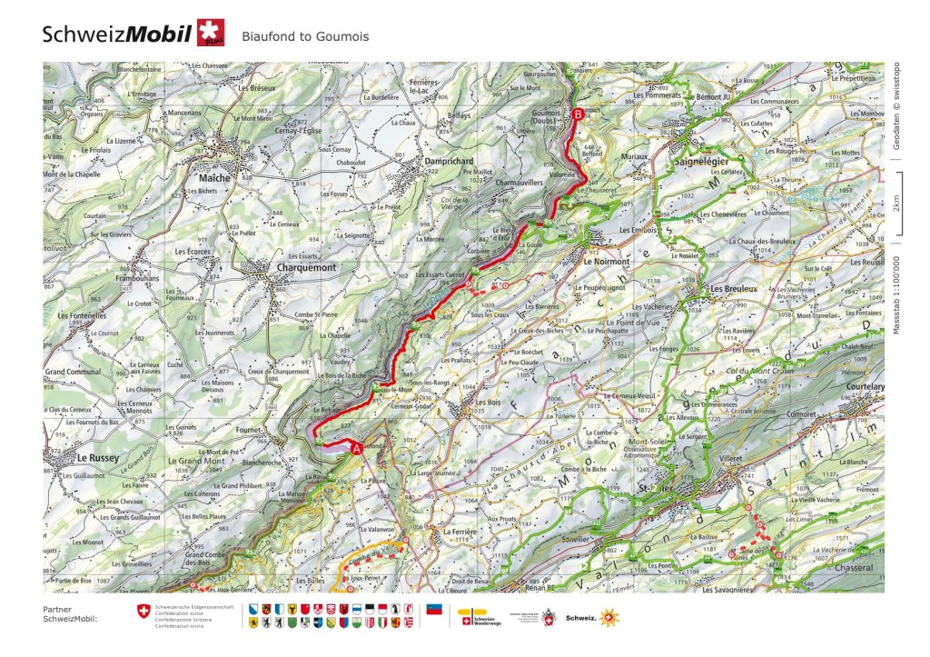
Click here to see this section on “SchweizMobil”
Day 3: Goumois to Soubey
Strapping on my backpack and tying up my hiking shoes this morning, I realized how sore I felt on my back and my feet from the past two long days of hiking. Something I hoped, I will stop noticing after a while. After a very generous breakfast, I headed out direction Soubey; todays section was the shortest of the four. The bikers from yesterday crossed my way, strapping on their luggage on their bikes. After asking me where I came from and where I am headed, they congratulated me on my courage and wished me safe travels. Something, that somehow made me feel very proud and adventurous. The day started again in several shades of grey and with a lot of clouds but without rain. To my surprise I came to enjoy this weather, especially given the promise of the last days, that in the afternoon, the sun comes out.
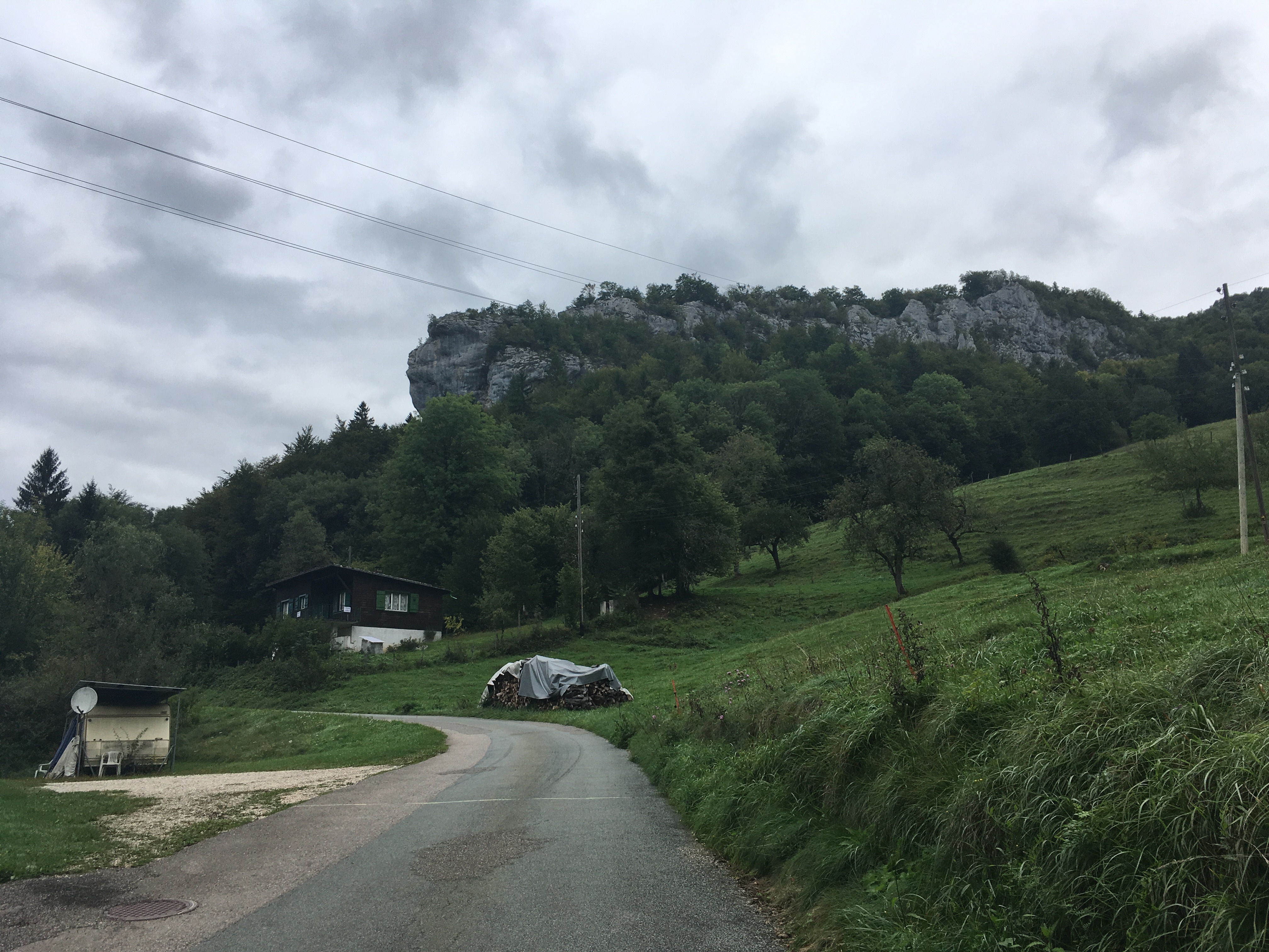
The path started on an asphalt road; ahead of me I could spot the “monkey rock”. A rock formation that looks like the profile of a monkeys head, that had already fascinated me as a kid. It looks like he is watching closely over the river valley below him, a serious look on his face. The path changes after a while from asphalt to a gravel road, sticking closely to the riverbank. Unlike the previous day, today the path barely led away from the Doubs, occasionally switching from wider paths to smaller trails.

I always had reservations about valley-hikes. I prefer to be up on a plateau, where I have an infinite view and the sky right above me. So I was sceptical if I will enjoy walking through a valley for more than one short day hike. But what I came to realize, there are amazing infinite views in a valley too. They might turn into a narrow canyon, high rocks left and right and suddenly become a vast open field surrounded by rolling hills. And to walk with the stream of a river has a fascinating driving energy to it.
In one of those open sections of the valley I made rest to eat my lunch, enjoying once again the quiet of my surroundings; not one other person around.
As hoped, shortly after I left my lunchspot, the sun reappeared, making for some beautiful light-and-shadow plays in the forest to my right.
At half past 2 I already reached Soubey, a small village right at the river. While I was still deciding how to continue my hike, I went to the Hôtel du Cerf for something to drink. The weather did not look good for the next day and even though I had a newfound appreciation and joy for hiking in a valley, I felt the strong urge, to go upwards, rather than continue the last section to St. Ursanne the next day.
This is something I came to appreciate as well when Solo-hiking: the adventure and freedom to change the course of your hike depending on your mood and the conditions in and around you 🙂
I decided to take a room in the hotel for the night and see the next day, where the road shall take me.

Click here to see this section on “SchweizMobil”
Day 4: Soubey to Le Creux-des-Biches
This morning I was greeted by heavy rain and a dark grey sky. Normally this is the kind of weather, that makes me decide to skip a section or call it quits a day early; but somehow this day it made me even more anxious to get out and start walking. I had made the decision late last night to abandon the river and hike back up to the plateau and make my way direction of the little hamlet of Le Creux-des-Biches, where my now-husband Sam was living at the time. I had the strong intention to not take any trains or buses, but really reach my final destination by foot. I was not yet sure, if I was going to make it, as my feet now very clearly “disagreed” with my hiking shoes; but the intention was enough for the moment, fueling that sense of adventure…
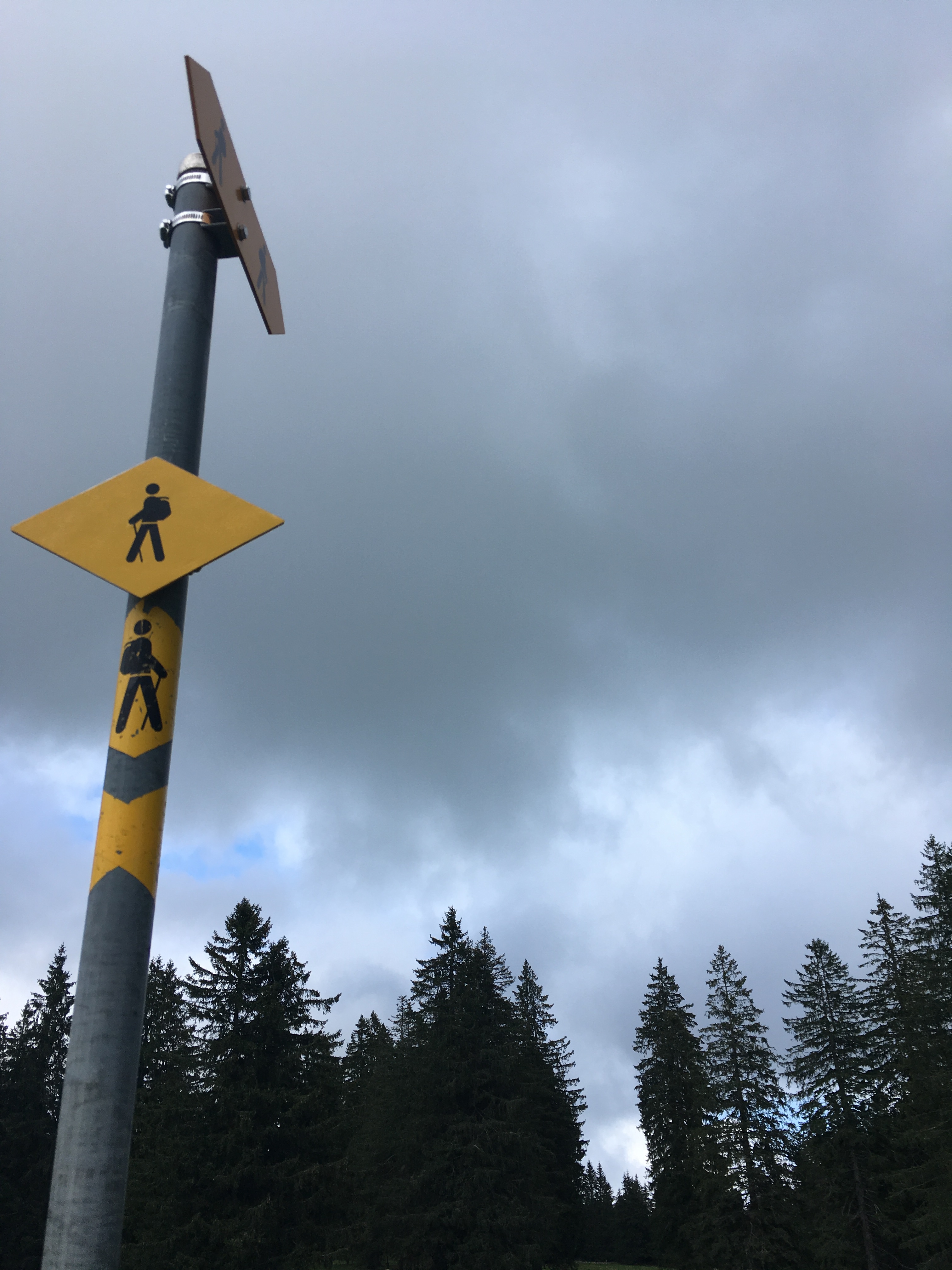
My backpack and myself wrapped in rainclothing, I followed the hiking sign direction Saignelégier and started the climb out of the valley immediately.
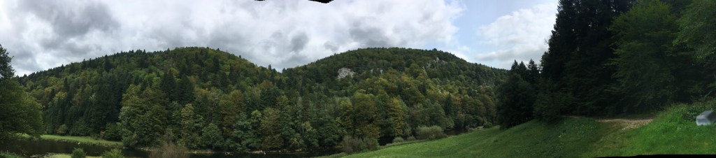
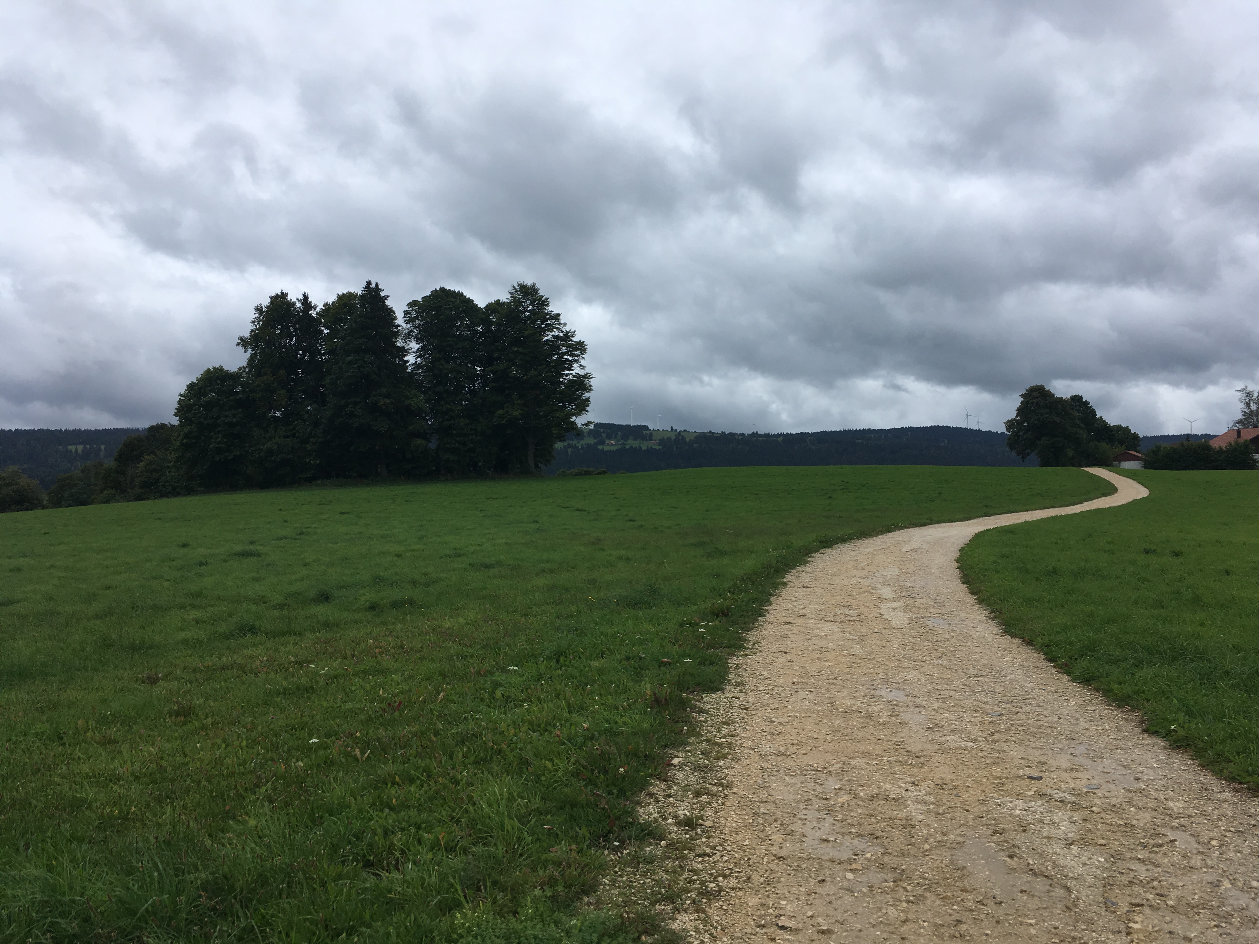
I walked over fields, at times with no clear path and occasionally it felt like a scavenger hunt to find the next hiking sign nailed to a tree or painted on a stone. Curious cow eyes observed my ascent out of the fog in the valley. For a short moment, I had to follow the busy road – something I dislike, as cars sometimes tend to keep their speed, rather than slowing down when passing hikers. But soon the path led me back on the grassy fields, higher and higher up, until I reached a small asphalt road and a panoramic view. I am sure, the view would have been even more beautiful, had it been a clear sunny day but I still deeply appreciated the rain and the wafts of fog covering the valley – I wouldn’t have had it any other way.
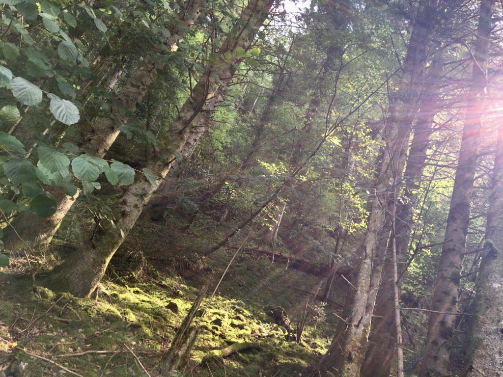
To my surprise I was still not done with my ascent; from the fields the path now turned into a very steep stoney road up through the forest. Because of the heavy rain in the night and all through the morning the ground was very slippery, muddy and unstable which turned out to be a bit of a challenging combination. After the very steep ascent the road turned into a more narrow path winding its way up, sometimes over little wooden bridges, through the forest. That was my one challenge in terms of my fear of heights: but after a couple of fast heartbeats I reached the end of it and continued the ascent on a wider path until I reached the end of the forest and the top. Those moments are always special to me: when you reach the end of an ascent and all you see is sky at the end, not knowing what will be expecting you on top. I was greeted by a vast field and a strong wind, energizing me, curious, where the road will lead me next.


The rain had stopped, as I got out of the valley; over green fields and on wide gravel roads I was led all the way up to the little village of Les Enfers. From there it took another 45 minutes to reach the hamlet of La Bosse. A little while before entering the hamlet, there is this tiny little chapel on the side of the road. I knew it from a prior visit with my mother but had no idea anymore, geographically where it was. It was a special thing, to run into something familiar so unexpectedly; and I couldn’t have reached it at a better moment as another rain shower with some heavy wind and lighting started. I found shelter inside until the storm was over, which luckily did not take too long.
From La Bosse I continued to Le Bémont and from there to Saignelégier. This was certainly the less interesting part of todays section. The road follows mostly the main car route. The view still is beautiful though, with typical Jurapastures and needle trees.
Having arrived in Saignelégier, I realized how wet and cold I was and treated myself to a hot chocolate in the Café du Soleil (fitting for the weather…) From there, the road directly continued to Muriaux, where I encountered some very curious young horses, who barely let me pass them, standing peacefully in front of me, as if they wanted me to tell them the story of my hike of the past days.
While I could now have followed the route via Les Emibois to Le Noirmont and from there headed directly to Le Creux-des-Biches in about an hour, I felt as though I am not yet done walking; so I decided to make a left turn and walk a little bit on the Trans Swiss Trail Section “Saignelégier to St. Imier” up to Le Roselet, a foundation for horses and from there to Les Breuleux. The route from Les Breuleux to Le Creux-des-Biches has in the meantime become one of my favorite little half-day hikes, that I do repeatedly. It allows you an almost constant vast view over Jurapastures, rolling hills, and the many windmills.
I was glad to have chosen to spend the final day of my solo hike up on the plateau and to have succeeded in ending my 4-day-hike in Le Creux-des-Biches greeted by Sam; soaking wet, proud, tired and full of unique impressions and a closer understanding of myself.


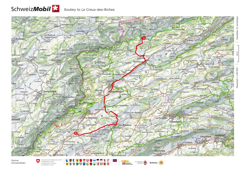
Click here to see this section on “SchweizMobil”
All in all, this is a very recommendable hike for someone with a fear of heights as well as for your first multiple-day-solo-hike-outing! The path is easy to follow and presents no (or barely any) dangers in terms of exposedness, high altitude and such. And 4 days might seem like a short time, but one more thing that I learned while hiking: time definitely moves very differently on the trail and maybe even becomes a bit less relevant…


Route overview
- Duration: 4 Days
- Total distance: 69.75 km
- Total ascent/descent: 1’955m/1’581m
- Highest point: 1’268m
Day-by-day breakdown
| Day 1: La Chaux-de-Fonds to Le Locle | Difficulty: T1 (Hiking Trail) Length: 12.59 km Duration: 3:20 h Ascent/Descent: 340m/398m |
| Day 2: Biaufond to Goumois | Difficulty: T1 (Hiking Trail) Length: 18.20 km Duration: 4:45 h Ascent/Descent: 457m/544m |
| Day 3: Goumois to Soubey | Difficulty: T1 (Hiking Trail) Length: 12.90 km Duration: 3:20 h Ascent/Descent: 197m/215m |
| Day 4: Soubey to Le Creux-des-Biches | Difficulty: T1 (Hiking Trail) Length: 26.06 km Duration: 7:19 h Ascent/Descent: 961m/424m |
Some more useful facts about this hike
| Best season: This hike works well for Spring, Summer and Autumn. For a Winter edition it is important to check the snow conditions. In Summer walking along the river in the cooler valley feels particularly nice. |
| Trail exposure: Minimal. The only slightly challenging part in terms of height and exposedness is the section up the hill from Soubey direction Les Enfers. |
- After a lot of rainfall, the path from Soubey up to Les Enfers might be quite muddy and slippery, which should be considered when hiking. There is the option to take the Bus between Soubey and Les Enfers.
- There are overnight possibilities at the end of every section; but as they are minimal, it is worth to make a reservation beforehand, especially if you are not hiking off-season.
- If you are a fish-eater: try the trout in one of the many restaurants along the doubs (for example in Le Theusseret) it is supposed to be very delicious.

Leave a comment